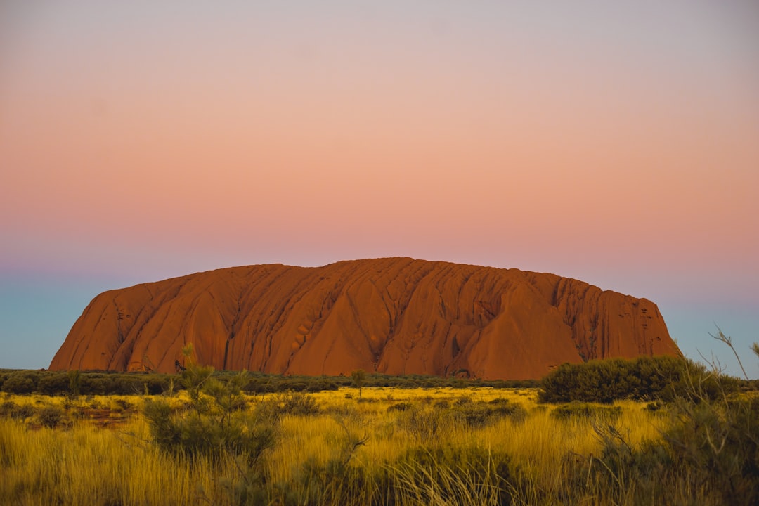
Australia's outback drives are at their best from May to October, the dry season, when the heat backs off, the dirt tracks firm up, and the wet-season floods have drained away. The standouts are the Red Centre loop around Uluru and Kings Canyon, the Kimberley's Gibb River Road, and the Savannah Way from Cairns to Broome. Late September falls at the tail of that window, so the next few weeks are the time to go before the build-up humidity returns to the north.
Every drive below is ranked with the real distance, number of days, and open months from its route guide, and each one tells you plainly whether you need a four-wheel drive or can manage in a normal car. A few are sealed highways you could take on a first outback trip. Others are permit-only desert crossings for experienced convoys. For more remote driving beyond Australia, the Adventure and Overland hub gathers the rest of the world's back-country routes.
The 10 best outback road trips at a glance
All ten sit in Australia, so the table shows the vehicle you need in place of the country. Distances, days, and dry-season windows come straight from each route's page. Several tracks close after rain and stay shut until graders reopen them, so plan around the real months, not the calendar.
| # | Route | Distance | Duration | Best months | Vehicle |
|---|---|---|---|---|---|
| 1 | Uluru and the Red Centre | 1,225 km | 5 days | April to October | Any car |
| 2 | Gibb River Road | 660 km plus gorges | 7 days | May to October | 4WD |
| 3 | Savannah Way | 3,700 km | 18 days | May to October | 4WD |
| 4 | Stuart Highway | 2,835 km | 9 days | May to September | Any car |
| 5 | Cape York, Old Telegraph Track | 1,250 km | 8 days | May to November | 4WD |
| 6 | Tanami Track | 1,060 km | 5 days | May to September | 4WD |
| 7 | Alice Springs to Darwin | 1,700 km | 6 days | May to September | Any car |
| 8 | Gunbarrel Highway | 1,500 km | 7 days | May to September | 4WD |
| 9 | Nullarbor and Eyre Highway | 1,200 km | 4 days | Spring or autumn | Any car |
| 10 | Canning Stock Route | 1,850+ km | 21 days | May to September | 4WD |
If you only do one
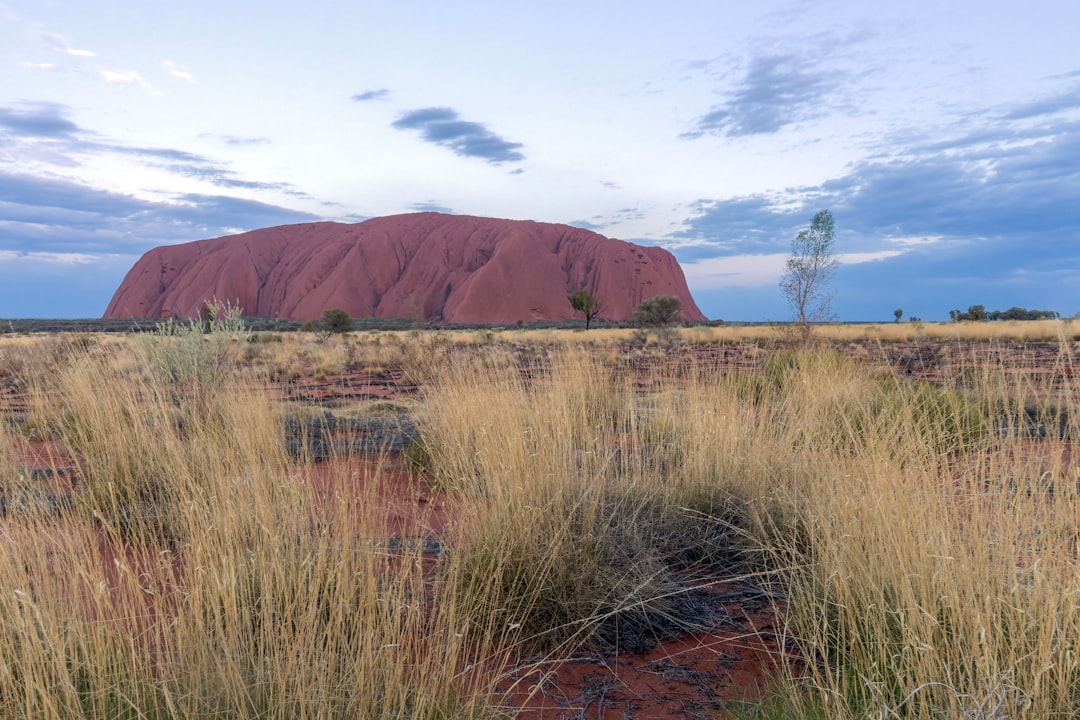
Drive the Red Centre. Over five days and 1,225 km you cover Uluru and Kata Tjuta, the rim and creek walks at Watarrka (Kings Canyon), and the West MacDonnell gorges out of Alice Springs, from Standley Chasm to Ellery Creek Big Hole and Ormiston Gorge. The roads to the icons are sealed, so a normal car handles the trip, and the season runs April to October. Walk at first light before the heat, check the Parks Australia access notices the same morning, and respect the cultural closures and photography requests around Uluru. It is the outback at its most concentrated, and the most forgiving for a first attempt.
1. Uluru and the Red Centre
The Red Centre is where most people meet the outback, and it earns the top spot by packing the desert's greatest hits into a five-day, 1,225 km run on sealed roads. Base yourself at Yulara for Uluru and Kata Tjuta, add the Kings Canyon rim walk at Watarrka, then finish with a day loop through the West MacDonnell Ranges west of Alice Springs. Ormiston Gorge and Ellery Creek Big Hole hold water long into the dry, which makes them good midday swims. Rated moderate and drivable in any car, it is the trip to book first.
2. Gibb River Road
The Gibb River Road crosses the Kimberley on 660 km of dirt from Derby to Kununurra, plus the side tracks into the gorges, and it is the four-wheel-drive trip Australians save for. Windjana Gorge and Tunnel Creek sit near the start, Bell Gorge and Manning Gorge break up the middle with waterfall pools, and Home Valley and El Questro stations bookend the eastern end. It is rated hard, needs a proper 4WD with good tyres, and opens only in the dry, May to October, once the creek crossings drop. Check the Main Roads Gibb River Road page and each station before every leg.
3. Savannah Way
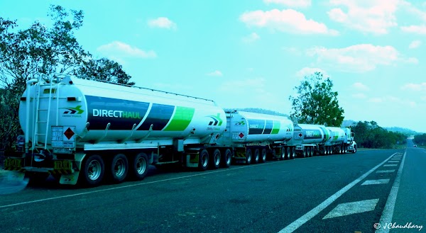
The Savannah Way is the great tropical crossing, 3,700 km over 18 days linking Cairns to Broome through the top of the country. It mixes long sealed runs with red-dirt detours, past the Undara lava tubes, the Gulf towns of Normanton and Karumba, the gorge country of Boodjamulla, and the wetlands near Borroloola before Katherine, Halls Creek, and Fitzroy Crossing. The remote Gulf option needs a 4WD, and the whole line is a dry-season drive, May to October. Give the road trains room and refuel at every town.
4. Stuart Highway
The Stuart Highway runs Australia's north-south spine, 2,835 km of sealed road from Adelaide's fringe to Darwin over about nine days. It threads the opal-mining moonscape of Coober Pedy, the balancing boulders of Karlu Karlu near Tennant Creek, and the gorge at Nitmiluk before the Top End. Because it is paved the whole way, any car can do it, though the outback rules still apply: cap driving at eight hours a day, rest every two hours, and avoid dawn, dusk, and night when wildlife moves onto the road.
5. Cape York via the Old Telegraph Track
The drive to Cape York ends at Pajinka, the northernmost point of the Australian mainland, 1,250 km from Cairns staged over eight days. The trip splits in two: the Peninsula Developmental Road that most vehicles use, and the optional Old Telegraph Track, a chain of technical creek crossings you can bypass at any point. Laura, Archer River, and Bramwell mark the way north to the Jardine River ferry and Bamaga. It is rated extreme, needs a capable 4WD and recovery gear, and runs May to November.
6. Tanami Track
The Tanami Track cuts 1,060 km of desert from Alice Springs to Halls Creek across Warlpiri and Kukatja country, five days of corrugated red dirt and near-total solitude. The one detour everyone stops for is Wolfe Creek Crater, a 900 m meteorite scar near the northern end. This is remote 4WD driving that needs an Aboriginal-land transit permit, spare tyres, and a satellite backup, and it closes after rain. The season is May to September. Check the NT and Halls Creek road reports before every leg.
7. Alice Springs to Darwin
If you want the outback without the full spine, the sealed Alice Springs to Darwin run covers the best of the Top End in six easy days and 1,700 km, Litchfield included. It follows the northern Stuart Highway past Karlu Karlu and Tennant Creek, then leans into water: the thermal pools at Mataranka, the gorge at Nitmiluk near Katherine, and the waterfalls and plunge pools of Litchfield before Darwin. Rated easy and fine in any car, it is the gentlest way to taste the desert and the tropics on one drive, May to September.
8. Gunbarrel Highway
The Gunbarrel Highway is a serious desert expedition, 1,500 km from Wiluna over the original Gunbarrel corridor to Warburton, then along the Great Central Road through Warakurna and Docker River to Yulara. Carnegie Station and a few roadhouses are the only fuel and food for long stretches, so this is convoy driving. It is rated extreme, needs a 4WD and several Aboriginal-land transit permits arranged well ahead, and runs May to September.
9. Nullarbor Plain and Eyre Highway
The Nullarbor crossing runs the sealed Eyre Highway 1,200 km from Ceduna to Norseman across the treeless southern plain, an easy four days of vast straightaways broken by coastal detours. The Bunda Cliffs drop straight into the Southern Ocean, and the Head of Bight is one of the country's best places to watch southern right whales, which gather offshore in the cooler months. Roadhouses at Nullarbor, Border Village, and Eucla space out the fuel. It suits any car, and spring or autumn beats the summer heat, so late September is well timed.
10. Canning Stock Route
The Canning Stock Route is the hardest drive in the country, a 1,850 km expedition from Wiluna to Halls Creek along a chain of old stock wells, budgeted at 21 days including three for contingency. There is one resupply point, the community store at Kunawarritji near Well 33, so vehicles carry weeks of fuel, food, and water. It demands a current Yiwarra Kuju permit, a self-sufficient convoy, and real desert experience. Rated extreme and open May to September, it is the outback stripped to its bones, and it is not a first trip.
Frequently asked questions
When is the best time to drive the Australian outback?
The dry season, roughly May to October across the north and centre. The heat and humidity ease, the unsealed tracks firm up, and the wet-season creek crossings drop to passable levels. Late September sits near the end of that window, so it is a good time to go before the pre-wet build-up returns to the tropical north.
Do you need a 4WD for the outback?
Not always. Sealed drives like the Red Centre, the Stuart Highway, Alice Springs to Darwin, and the Nullarbor are fine in a normal car. The dirt routes, including the Gibb River Road, the Tanami Track, the Gunbarrel Highway, Cape York, and the Canning Stock Route, need a proper high-clearance 4WD, good tyres, and recovery gear.
Which outback road trip is best for a first-timer?
The Red Centre or the Alice Springs to Darwin run. Both are sealed, both are rated easy to moderate, and both string the desert's landmarks together without asking for off-road skills or permits. The Red Centre packs the most into the fewest days.
Do you need permits to drive outback tracks?
Some of them, yes. Routes that cross Aboriginal land, including the Gunbarrel Highway, the Tanami Track, Cape York, and the Canning Stock Route, require transit permits arranged before you leave. The sealed highways do not. Always confirm current requirements on the relevant land council and road authority pages.
How far apart are fuel and supplies out there?
On remote tracks, services can be hundreds of kilometres apart, and some roadhouses keep limited hours. Refuel at every town, carry reserve fuel, water, food, and tyre repair kit, and take a satellite phone or beacon where there is no mobile signal.
Ready to plan it? Start with the full Red Centre route guide, then open the interactive map to line these drives up against your own dates and the dry-season window.