
Nicaragua Volcano Route
Nicaragua
In short: Nicaragua Volcano Route is a 420 km adventure road trip in Nicaragua, typically driven over 5-7 days, best in December to April. Highlights: León, Cerro Negro Volcano, Telica Volcano.
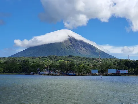
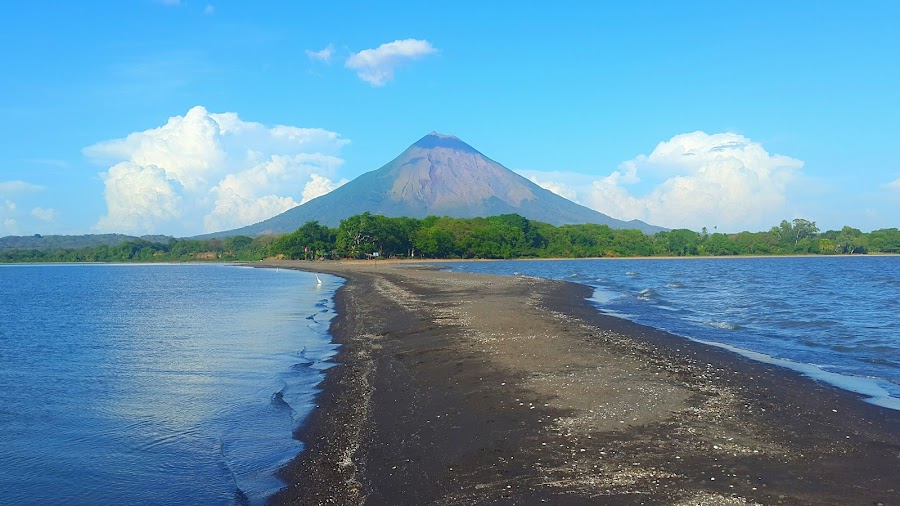
This volcanic corridor links Nicaragua’s most dramatic landscapes, from the colonial streets of León to the smoking crater of Masaya and the lava fields around Cerro Negro. It finishes on Ometepe’s twin volcano island, pairing black-sand shores, crater viewpoints, and classic Pacific coast driving. The drive is one-way from León to Ometepe; most travelers exit via the Rivas/Managua corridor rather than looping back to León.
Make this route yours
Set your dates, pace, and taste, and RoadAtlas AI rebuilds this trip day by day with real, verified places.
Included with Traveler and Explorer plans.
Plan this trip
Third-party planning links may be affiliate links. RoadAtlas stays independent, and you should verify details with the provider.
Day-by-day itinerary
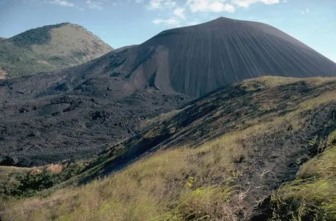
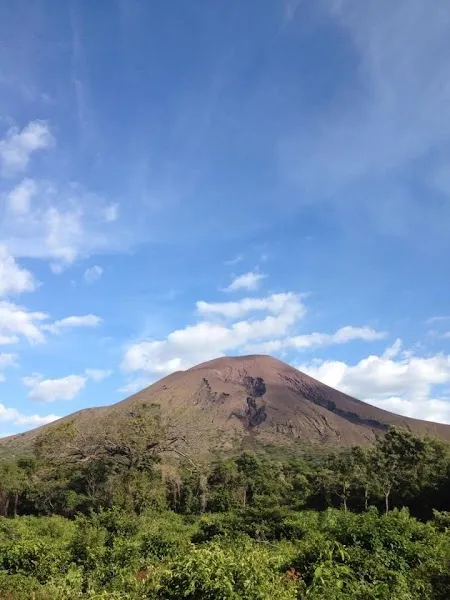
Day 1León and Cerro Negro
Licensed Cerro Negro volcano-boarding tour · El Sesteo
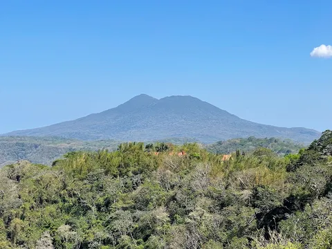
Day 2León and Telica
Guided Telica sunset hike · El Desayunazo
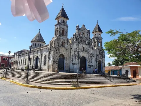
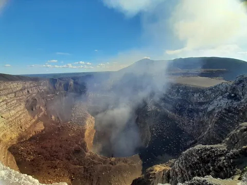
Day 3León to Granada via Masaya
Masaya Volcano National Park · Granada historic center · The Garden Café
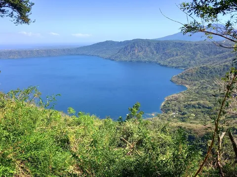
Day 4Mombacho and Laguna de Apoyo
Mombacho cloud-forest trails · Laguna de Apoyo swim · Paradiso
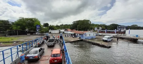
Day 5Granada to Ometepe via the San Jorge ferry
Reserved San Jorge vehicle ferry · Punta Jesús María sunset · Mercado Municipal de Rivas
Day 6Ometepe Island
Ojo de Agua · Maderas lower-slopes walk · Café Campestre
Stops along the route

Things to Do
Show 5 more
Where to Eat

Nearby and similar drives

Frequently asked questions
How long is the Nicaragua Volcano Route drive?
The Nicaragua Volcano Route covers 420 km from start to finish.
How long does the Nicaragua Volcano Route take to drive?
Most travellers spend 5-7 days on the Nicaragua Volcano Route, depending on stops and pace.
When is the best time to drive the Nicaragua Volcano Route?
The recommended season for the Nicaragua Volcano Route is December to April.
Where does the Nicaragua Volcano Route start and end?
The Nicaragua Volcano Route runs from León to Ometepe Island.
What are the main stops on the Nicaragua Volcano Route?
The Nicaragua Volcano Route passes through León, Cerro Negro Volcano, Telica Volcano.
How difficult is the Nicaragua Volcano Route to drive?
The Nicaragua Volcano Route is rated moderate and is best handled with suv only.
Do I need a 4WD for the Nicaragua Volcano Route?
Yes — the Nicaragua Volcano Route includes off-road or rough sections that require suv only.
How many fuel stops are needed on the Nicaragua Volcano Route?
Plan around 0 refuels (or about 1 EV charges) along the Nicaragua Volcano Route, based on its 420 km length.
Is the Nicaragua Volcano Route safe to drive?
The intercity roads are mostly paved, but the access for Cerro Negro, Telica, and some Mombacho activities is steep or rough. Reserve licensed local operators and use their 4WD transfers rather than taking an ordinary rental car onto volcano tracks; activity access can change with volcanic conditions. If taking a vehicle to Ometepe, reserve the San Jorge ferry space in advance, arrive early with the vehicle documents, and reconfirm sailing conditions. Carry cash for rural entrances, drive only in daylight, and review Nicaragua’s current security advisory before travel.
What scenic tier is the Nicaragua Volcano Route?
The Nicaragua Volcano Route is a notable drive — Notable scenic drives — strong character routes that locals know well and that reward travellers willing to step beyond the most-photographed roads.