Two to four days is the sweet spot for the Cabot Trail. That gives you time to drive the full 298 km loop around Cape Breton Island, hike the Skyline Trail, watch for pilot whales at Pleasant Bay, and still linger in the Acadian and Highland villages without racing the light. You can lap it in a single long day, but a road that climbs 300 m sea cliffs deserves to be slowed down.
This is a stop-by-stop plan built around the real towns and lookouts on the Cabot Trail, one of the most scenic drives in North America. It is a moderate, fully paved loop through Nova Scotia that suits any vehicle, including EVs, so the only real planning is where to stop, which direction to drive, and when to go.
The Cabot Trail at a glance
The Cabot Trail is a 298 km loop that starts and finishes in Baddeck on the Bras d'Or Lake, climbs over the Cape Breton Highlands, and drops to sea-level fishing villages along the way. It traces cliff edges with 300 m drops into the Gulf of St. Lawrence, threading a boreal plateau where moose graze at the roadside and bald eagles ride the thermals overhead.
- Distance: 298 km loop, Baddeck to Baddeck
- Time needed: 2 to 4 days (2 is the classic first-timer plan)
- Difficulty: moderate, paved, any vehicle
- Best season: June to October
- EV-friendly: yes
A quick word of caution: several sections involve steep grades and tight curves along unguarded cliff edges, so manage your speed carefully, especially in wet weather. Winter driving can be hazardous and the Highland sections may close with heavy snowfall, so check Cape Breton Highlands National Park road conditions before you leave.
How many days do you need?
The honest answer depends on how much you want to stop. Here is what each length of trip realistically buys you.
| Trip length | What you fit | Best for |
|---|---|---|
| 1 day | The full loop, a couple of overlooks, and one short walk | A fast transit with the headline views |
| 2 days | The above plus the Skyline Trail, Cheticamp, and a whale tour | First-timers who want the full trail |
| 3 to 4 days | Side roads to Meat Cove, unhurried village time, and extra hikes | Slow travel, hikers, and photographers |
A one-day blast around the loop is the most common mistake. The middle of the trail, where the road rides the escarpment inside Cape Breton Highlands National Park, holds some of the best coastal views on the continent, and they reward the people who arrive early and linger.
Which direction should you drive?
The catalog routes the loop counterclockwise, starting in Baddeck and heading up the Gulf of St. Lawrence side through Margaree and Cheticamp first. Many drivers prefer this direction because it puts you on the inside lane for the climb over the Highlands, away from the cliff edge. Either way works, but decide before you set off so you can time the big overlooks for good light.
Day 1: Baddeck and the Acadian coast
Start in Baddeck, the friendly hub on the Bras d'Or Lake where Alexander Graham Bell summered. His estate, Beinn Bhreagh, and the Alexander Graham Bell National Historic Site anchor the town and make a worthwhile stop before you head north. Fuel up and stock the cooler here.
Follow the Gulf shore to Cheticamp, a proudly Acadian fishing village. This is the place for fresh snow crab at the co-op wharf and for the vibrant hooked-rug tapestries that hang in every gallery. Visit Les Trois Pignons to see the Acadian history and the art of rug hooking up close, then settle in for the night with a seafood dinner. L'Abri serves fresh, modern seafood with ocean views.
Day 2: the Highlands, Skyline Trail, and Pleasant Bay
This is the big scenery day. North of Cheticamp the road enters Cape Breton Highlands National Park, a boreal plateau with 300 m sea cliffs along the western escarpment. The signature walk here is the Skyline Trail, a gentle loop out to a headland boardwalk with panoramic views over the Gulf of St. Lawrence. Time it for the softer light of morning or late afternoon, and keep an eye out for moose in the meadows.
Drop down to Pleasant Bay, where pilot whales feed just offshore all summer. Zodiac tours from the wharf offer near-certain close encounters, and the village is a good spot for lunch at a local favorite like The Rusty Anchor. From here the trail swings north toward the loop's remote top.
Day 3: Cape North, Ingonish, and back to Baddeck
Cape North is the northernmost community on the loop, a quiet crossroads where side roads lead out to Meat Cove and Cabot Landing Beach. If you have the extra day, the rough drive to Meat Cove is Nova Scotia at its wildest, a cluster of homes on a headland at the literal end of the road.
Round the top and follow the Atlantic coast south to Ingonish, where a freshwater lake sits separated from the ocean by a slender sand bar, with the Keltic Lodge crowning the headland above the surf. Ride the Cape Smokey Gondola for a last big view over the Highlands and the sea, grab a bite at the Main Street Restaurant and Bakery, then trace the shore back to Baddeck, closing the loop on the Bras d'Or Lake.
When to drive the Cabot Trail
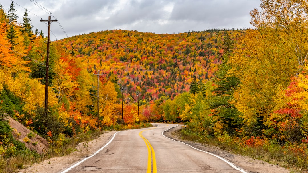
The catalog season is June to October, when the Highland passes are clear and the days are long enough to fit every stop without rushing. Early October is the local highlight, when the hardwood forests of the Highlands turn gold and red and the trail becomes one of the best fall-color drives in the world. Outside that window, expect winter closures in the Highland sections and difficult, sometimes icy, driving.
Wildlife is part of the experience and part of the risk. Moose appear at the roadside, especially at dawn and dusk, so drive slowly through the dim hours and never block traffic to get a photo. With steep grades and tight, unguarded curves, patience matters more than pace on this trail.
Frequently asked questions
How many days do you need to drive the Cabot Trail?
Two days is the classic plan. It lets you drive the full 298 km loop, hike the Skyline Trail, visit Cheticamp, and take a whale tour at Pleasant Bay without rushing. One day covers the headline views if you keep moving, while three to four days suits slow travel, the side road to Meat Cove, and extra hikes.
Which direction is best to drive the Cabot Trail?
The trail is a loop, so both directions work. The catalog routes it counterclockwise from Baddeck, up the Gulf of St. Lawrence side through Cheticamp first, which keeps you on the inside lane away from the cliff edge for much of the Highland climb. Choose your direction before you start and time the big overlooks for good light.
When is the best time to drive the Cabot Trail?
June to October. Summer brings long days and clear passes, while early October delivers the famous Highland fall colors. Outside that window, expect winter closures and hazardous conditions in the Highland sections, so check Cape Breton Highlands National Park road reports before you go.
Is the Cabot Trail difficult to drive?
It is rated moderate. The road is fully paved and suits any vehicle, but several sections have steep grades and tight curves along unguarded cliff edges, so speed management matters, especially in wet or icy weather. Take the Highlands slowly and you will be fine.
Can you see whales from the Cabot Trail?
Yes. Pleasant Bay is the best-known spot, where pilot whales feed just offshore all summer and zodiac tours from the wharf offer near-certain close encounters. Watch for them along the Highland coast too.
Plan your drive
Ready to map it out? See the full Cabot Trail route guide for every stop in order, compare it with British Columbia's Sea to Sky Highway, the Icefields Parkway, or the Blue Ridge Parkway, and build your own version on the interactive map.