Give Baja California Highway 1 ten days to two weeks, and start between October and April. That window skips the worst of the summer heat, puts you on the peninsula while grey whales are calving in the Pacific lagoons, and leaves room to drive all 1,700 km from Tijuana to Cabo San Lucas without rushing the long desert gaps.
This is a stop-by-stop plan for the full run down Baja California Highway 1, the Carretera Transpeninsular that links the two Baja states from the US border to Land's End. It is a moderate drive on a narrow, mostly two-lane road, so the planning that matters is pacing, fuel, and daylight rather than technical skill. Any vehicle can do it, long empty desert stretches included.
Baja Highway 1 at a glance
- Distance: 1,700 km, Tijuana to Cabo San Lucas
- Time needed: 10 to 14 days
- Difficulty: moderate, suitable for any vehicle
- Best season: October to April
- Border: you cross from the US at Tijuana and change states at Guerrero Negro
- Fuel: fill up in every town, because the gaps between stations through the center are long
Plan the whole trip around driving in daylight. The highway is narrow, shoulders come and go, and livestock wander onto the road after dark, so aim to reach each night's stop before dusk.
How many days do you need?
Ten days covers the peninsula at a steady pace. Twelve gives you room for the wine country and the whale lagoons. Fourteen lets you slow down on both coasts and take the mission roads inland.
| Trip length | What you fit | Best for |
|---|---|---|
| 10 days | Tijuana to Cabo at a steady clip, the main towns, one whale lagoon | A fixed vacation window |
| 12 days | The above plus Valle de Guadalupe and a full day in La Paz | A balanced first trip |
| 14 days | The full peninsula unhurried, mission roads, both coasts, extra whale time | Slow travel and photographers |
The section most people shortchange is the central desert between El Rosario and Santa Rosalía. Services thin out, cardón forests take over, and the driving slows down, so give that stretch its own days instead of crossing it in one long push.
Days 1 to 3: Tijuana to El Rosario
The first days run down the Pacific coast of the northern state. Cross at Tijuana, handle your tourist permit and Mexico liability insurance, and if you want a proper meal before the distances open up, Misión 19 cooks modern Baja plates with a deep local wine list. South along the coast, Ensenada is the wine-country port, with ceviche and tostada carts on the waterfront (La Guerrerense is the one people line up for) and the vineyards of Valle de Guadalupe a short detour inland. Farther down the Pacific side, San Quintín is a farming bay that works as a seafood and fuel stop, with Mariscos El Mazateño the local pick for shrimp. Spend the third night in El Rosario, the last comfortable town before the highway swings inland into the desert.
Days 4 to 6: El Rosario to Santa Rosalía
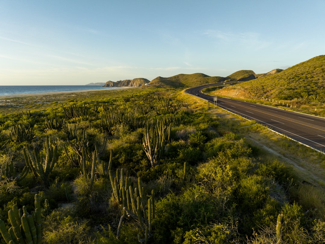
South of El Rosario the road climbs into Valle de los Cirios, a huge reserve where cardón cacti and the twisting boojum trees frame the highway. This is the empty center of the peninsula, so carry water and keep the tank full. The desert run ends at Guerrero Negro, the salt-flat town that marks the state line into Baja California Sur. In winter it becomes the gateway to Laguna Ojo de Liebre, where grey whales come to calve, and Tacos Marco Antonio near the fuel pumps makes a quick stop before or after the crossing. Inland sits San Ignacio, a palm oasis built around a 1786 Jesuit mission and ringed by volcanic peaks. The leg finishes on the Sea of Cortez at Santa Rosalía, a former French copper-mining town with faded boomtown storefronts and a prefabricated iron church designed by Gustave Eiffel's firm.
Days 7 to 9: Loreto and the Sea of Cortez
The gulf coast is the quiet reward of the trip. Loreto sits on a calm bay and holds the first Spanish mission in the Californias, founded in 1697, and Los Magueyes is a dependable table for fish and shrimp after a day on the water. Set aside a morning for the drive up to Misión San Javier, a stone mission in the sierra above town and one of Baja's most atmospheric colonial sites. From here Highway 1 cuts back toward the Pacific at Ciudad Constitución, a flat farming town that works as the base for whale-watching tours in Magdalena Bay.
Days 10 to 14: La Paz to Cabo San Lucas
The final days belong to the cape. La Paz, the state capital, is the most relaxed city on the peninsula, with sunset walks along the malecón and boat trips out to Espíritu Santo to swim with sea lions. Highway 1 then runs its last stretch to Cabo San Lucas, where the desert meets the water at Land's End, the rock arch where the Pacific and the Sea of Cortez join. With the full two weeks, this is the place to spend the spare days, trading driving for beaches before you turn north or fly home.
When to drive Baja Highway 1
The catalog season is October to April, and the reason is heat. Summers on the peninsula are punishing, especially across the central desert, so the cooler half of the year is when the drive is comfortable. Winter brings the main wildlife draw. Grey whales travel down from the north Pacific to the Baja lagoons to calve, and from roughly January to March you can watch them at Laguna Ojo de Liebre near Guerrero Negro and in Magdalena Bay off Ciudad Constitución. October and November stay warm and quieter, while the whale months fill the lagoon towns, so book those nights ahead.
Frequently asked questions
How many days do you need to drive Baja California Highway 1?
Plan for 10 to 14 days to cover the full 1,700 km from Tijuana to Cabo San Lucas. Ten days is a steady pace with the main towns and one whale lagoon, twelve adds the wine country and a slower day in La Paz, and fourteen lets you take the mission detours and both coasts without rushing.
When is the best time to drive Baja Highway 1?
October to April, once the heat eases across the desert. For grey whales in the Pacific lagoons, come between about January and March, the heart of calving season at Laguna Ojo de Liebre and Magdalena Bay.
Can you drive Baja California Highway 1 in a regular car?
Yes. The route is paved and rated moderate, so any vehicle handles it. The real challenges are the narrow two-lane road, the long gaps between fuel stations through the center, and the need to drive in daylight.
Is it safe to drive Baja California Highway 1?
Check the current official Mexico travel advisories before you book. The standard precautions carry the most weight here: drive only in daylight, avoid remote side roads unless locally cleared, stay calm and cooperative at the military checkpoints, and carry water, food, fuel, and offline maps for the empty stretches.
What do you need to cross the border into Baja?
Bring your passport and the tourist entry record (FMM) for the length of your stay, your vehicle registration, and Mexico-valid liability insurance, since a US or Canadian policy will not cover you. Baja normally does not require a temporary vehicle import permit unless you carry on to mainland Mexico by ferry.
Plan your drive
See the full Baja California Highway 1 route guide for every stop in order. Coming from the north, you can link it to the US Pacific Coast Highway, and if desert driving is the part you love, compare it with Death Valley. Build your own version, stop by stop, on the interactive map.