
Uruguay Coast
Uruguay
In short: Uruguay Coast is a 520 km scenic road trip in Uruguay, typically driven over 6 days, best in November-March. Highlights: Colonia del Sacramento, Montevideo, Piriápolis.
Trace Uruguay’s Atlantic shoreline from Colonia del Sacramento to Punta del Este, following a relaxed mix of riverfront towns, dune-backed beaches, fishing ports, and polished resort strips. The drive is mostly flat and well paved, with easy detours for sunset viewpoints, seafood lunches, and long seaside walks.
Make this route yours
Set your dates, pace, and taste, and RoadAtlas AI rebuilds this trip day by day with real, verified places.
Included with Traveler and Explorer plans.
Plan this trip
Third-party planning links may be affiliate links. RoadAtlas stays independent, and you should verify details with the provider.
Day-by-day itinerary
Day 1Colonia del Sacramento to Montevideo
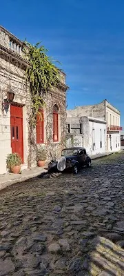
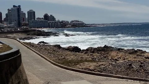
Colonia del Sacramento Historic Quarter · Montevideo Rambla · El Drugstore
Day 2Montevideo to Piriápolis
Cerro San Antonio · Casapueblo · La Rinconada
Day 3Piriápolis to Punta del Este
Punta del Este Marina · Punta del Este Beaches · Lo de Tere
Day 4Punta del Este to La Paloma
La Paloma Lighthouse · Punto Sur
Day 5Cabo Polonio and Punta del Diablo overnight
Cabo Polonio National Park · Punta del Diablo Beach Walk · Mar de Fondo
Day 6Santa Teresa and Chuy
Santa Teresa fortress and park · Confirmed Punta del Diablo breakfast
Stops along the route




Show 1 more

Things to Do





Where to Eat





Nearby and similar drives

Frequently asked questions
How long is the Uruguay Coast drive?
The Uruguay Coast covers 520 km from start to finish.
How long does the Uruguay Coast take to drive?
Most travellers spend 6 days on the Uruguay Coast, depending on stops and pace.
When is the best time to drive the Uruguay Coast?
The recommended season for the Uruguay Coast is November-March.
Where does the Uruguay Coast start and end?
The Uruguay Coast runs from Colonia del Sacramento to Chuy.
What are the main stops on the Uruguay Coast?
The Uruguay Coast passes through Colonia del Sacramento, Montevideo, Piriápolis.
How difficult is the Uruguay Coast to drive?
The Uruguay Coast is rated easy and is best handled with any vehicle.
Can I drive the Uruguay Coast in a regular car?
Yes — the Uruguay Coast is paved end-to-end and a regular car is fine in normal conditions.
How many fuel stops are needed on the Uruguay Coast?
Plan around 0 refuels (or about 1 EV charges) along the Uruguay Coast, based on its 520 km length.
Is the Uruguay Coast EV friendly?
Yes — the Uruguay Coast has charger coverage along the route and works as an EV road trip.
Is the Uruguay Coast safe to drive?
Cabo Polonio is reached via the authorized truck from Puerta del Polonio—not a private 4WD. Confirm schedule/capacity, reserve both transfer legs, carry food/water and check wind and weather; the Valizas walk/horse route is a separate planned activity. Use a non-tasting driver or winery transfer for any Bouza reservation. Day 4 ends in La Paloma, day 5 protects Cabo Polonio and one Punta del Diablo overnight, and day 6 covers Santa Teresa/Chuy.
What scenic tier is the Uruguay Coast?
The Uruguay Coast is a notable drive — Notable scenic drives — strong character routes that locals know well and that reward travellers willing to step beyond the most-photographed roads.