Copper Canyon mit geprüftem Veranstalter
Mexiko
Kurz gesagt: Copper Canyon mit geprüftem Veranstalter ist ein abenteuer Roadtrip von Abhängig vom Veranstalter in Mexiko, üblich in 5–6 Tage gefahren, ideal von April – Juni / September – November. Highlights: Chihuahua, Cuauhtémoc, Creel.
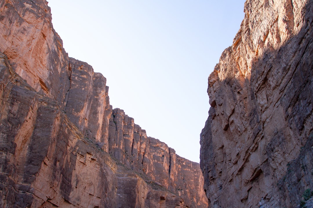
Eine vorsichtige, vom Veranstalter geführte Copper-Canyon-Route von Chihuahua über Creel und Divisadero zu einem Canyon-Arm bei Batopilas. Sie wird nicht als gewöhnliche unabhängige Selbstfahrerreise dargestellt.
Machen Sie diese Route zu Ihrer
Wählen Sie Termine, Tempo und Vorlieben, und die RoadAtlas-KI baut diese Reise Tag für Tag mit echten, geprüften Orten neu auf.
Enthalten in den Traveler- und Explorer-Tarifen.
Diese Reise planen
Planungslinks von Drittanbietern können Affiliate-Links sein. RoadAtlas bleibt unabhängig; überprüfe die Details beim Anbieter.
Reiseplan nach Tagen
Tag 1Chihuahua City nach Creel
Spaziergang durch das Zentrum von Creel · Sicherheits- und Routenbesprechung mit dem Veranstalter · Vom Veranstalter bestätigtes Hotelfrühstück in Chihuahua
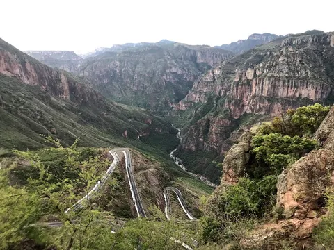
Tag 2Landschaften rund um Creel mit dem geprüften Veranstalter
Lago de Arareko · Valle de los Monjes · Gebuchte Hotelmahlzeiten in Creel
Tag 3Creel nach Divisadero
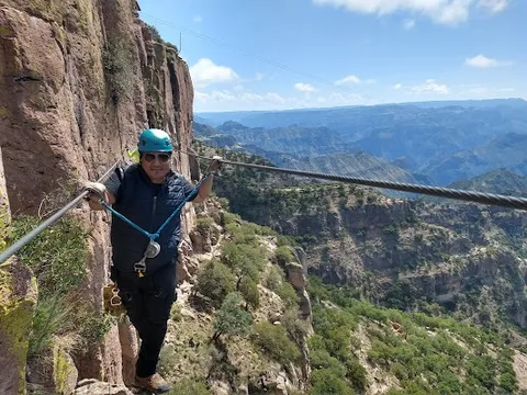
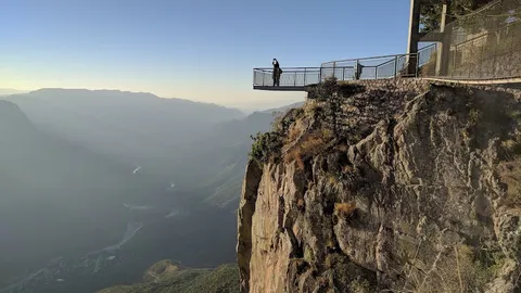
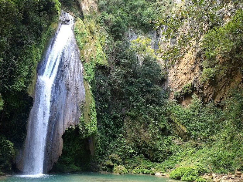
Aussichtspunkt Divisadero Canyon · Seilbahn des Copper Canyon Adventure Park · Vom Veranstalter bestätigte Mahlzeit im Hotel Divisadero Barrancas
Tag 4Divisadero nach Batopilas
Historisches Zentrum von Batopilas · Vom Veranstalter bestätigte Mahlzeit im Hotel Mary
Tag 5Batopilas und Satevó mit Puffer für die Rückfahrt
Templo de San Miguel de Batopilas · Mission Satevó · Gebuchte Mahlzeiten in der Unterkunft in Batopilas
Stationen der Route


Sehenswürdigkeiten & Aktivitäten


Wo man essen kann


Routen in der Nähe

Häufige Fragen
Wie lang ist die Copper Canyon mit geprüftem Veranstalter?
Die Copper Canyon mit geprüftem Veranstalter ist Abhängig vom Veranstalter lang.
Wie lange dauert die Copper Canyon mit geprüftem Veranstalter?
Die meisten Reisenden brauchen 5–6 Tage für die Copper Canyon mit geprüftem Veranstalter, abhängig von Stopps und Tempo.
Wann ist die beste Zeit für die Copper Canyon mit geprüftem Veranstalter?
Die empfohlene Reisezeit für die Copper Canyon mit geprüftem Veranstalter ist April – Juni / September – November.
Wo beginnt und endet die Copper Canyon mit geprüftem Veranstalter?
Die Copper Canyon mit geprüftem Veranstalter führt von Chihuahua nach Batopilas.
Was sind die wichtigsten Stationen auf der Copper Canyon mit geprüftem Veranstalter?
Die Copper Canyon mit geprüftem Veranstalter führt durch Chihuahua, Cuauhtémoc, Creel.
Wie schwierig ist die Copper Canyon mit geprüftem Veranstalter zu fahren?
Die Copper Canyon mit geprüftem Veranstalter gilt als schwer und wird am besten mit nur suv befahren.
Brauche ich einen 4x4 für die Copper Canyon mit geprüftem Veranstalter?
Ja — die Copper Canyon mit geprüftem Veranstalter enthält Off-Road- oder anspruchsvolle Abschnitte, die nur suv erfordern.
Ist die Copper Canyon mit geprüftem Veranstalter sicher zu fahren?
Die aktuellen offiziellen Hinweise für Chihuahua machen eine unabhängige Selbstfahrertour durch den Canyon ungeeignet. Prüfen Sie die aktuelle Warnung und überlegen Sie die Reise noch einmal; wenn Sie nach Annahme des Risikos trotzdem fahren, nutzen Sie einen seriösen Veranstalter oder eine Route per Bahn, reisen Sie nur tagsüber auf lokal freigegebenen Strecken und befolgen Sie die Hinweise der Rarámuri-Gemeinden. Der Plan nutzt nur den Batopilas-Arm, mit vom Veranstalter bestätigtem Transport, Unterkünften, Mahlzeiten, Kraftstoff und Wetterpuffern.
Welche Panoramastufe hat die Copper Canyon mit geprüftem Veranstalter?
Die Copper Canyon mit geprüftem Veranstalter ist eine ikonisch-Route — Ikonische Roadtrips, die den Ruf einer Region prägen — Postkartenlandschaften, Vorzeigerouten und die Strecken, die fast jeder fahren möchte.