G219 Kashgar–Lhatse Managed Expedition
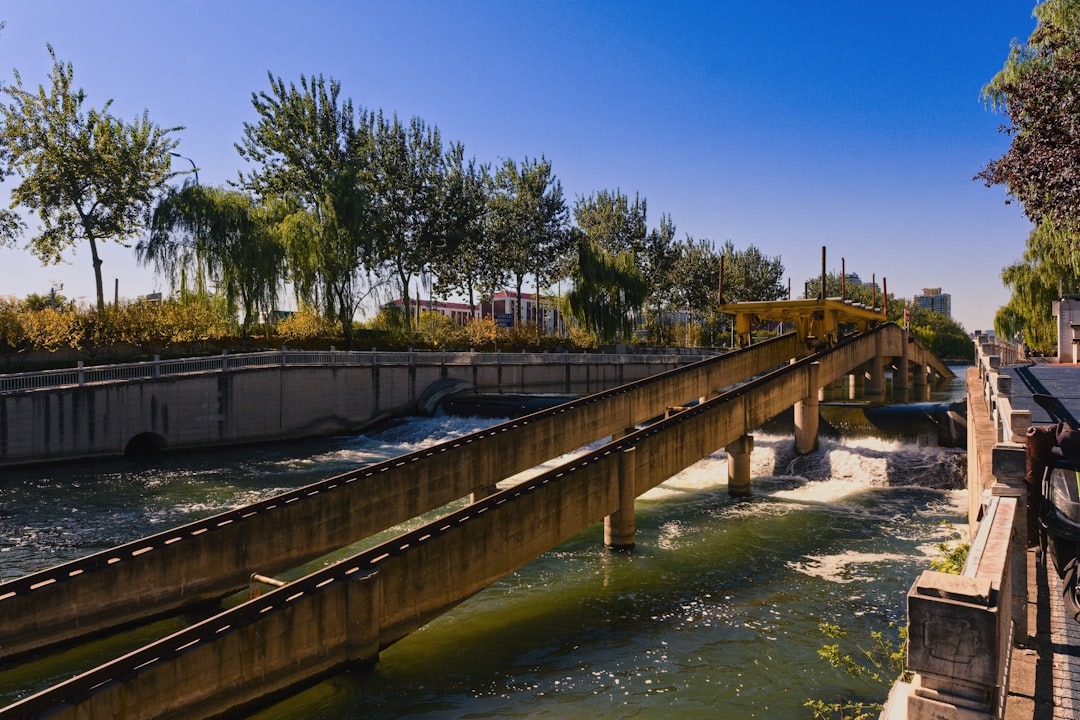
China
In short: G219 Kashgar–Lhatse Managed Expedition is a About 3,200 km including the declared Pamir out-and-back adventure road trip in China, typically driven over 19 days, best in June-September. Highlights: Kashgar, Karakul and Tashkurgan acclimatization loop, Yecheng G219 gateway.
A transparent 19-day managed journey: a clearly separated three-day Pamir acclimatization loop returns to Kashgar, then the classic G219 sequence runs through Yecheng, operator-set high-road stages, Bangong Tso, Shiquanhe, Zanda's earth forest and Guge–Tholing heritage, Mount Kailash viewpoints, Lake Manasarovar, Saga, Lhatse, and a final Sakya Monastery extension. It removes the hidden Karakul detour, filler airport stops, generic remote restaurants, and any implied Kailash kora.
Make this route yours
Set your dates, pace, and taste, and RoadAtlas AI rebuilds this trip day by day with real, verified places.
Included with Traveler and Explorer plans.
Plan this trip
Third-party planning links may be affiliate links. RoadAtlas stays independent, and you should verify details with the provider.
Day-by-day itinerary
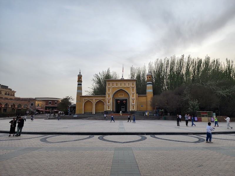
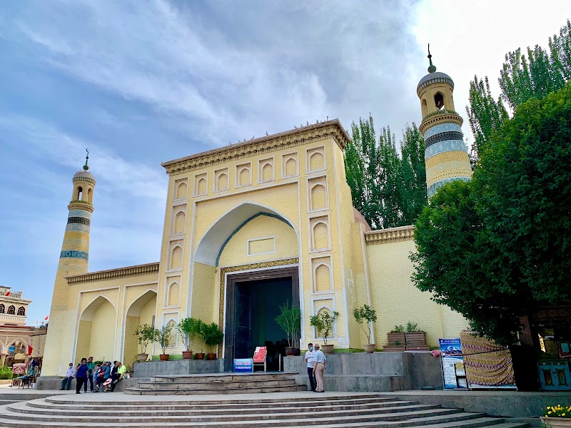
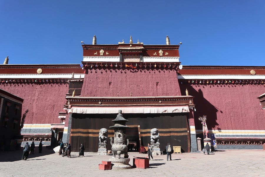
Day 1Kashgar heritage and expedition briefing
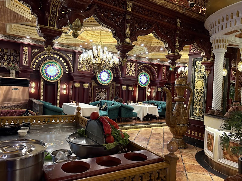
Kashgar Old City and Id Kah area · Licensed-operator expedition briefing · Nuolan Restaurant
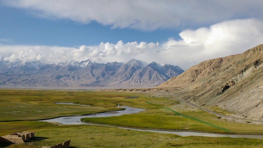
Day 2Kashgar to Karakul Lake and Tashkurgan — separate Pamir excursion
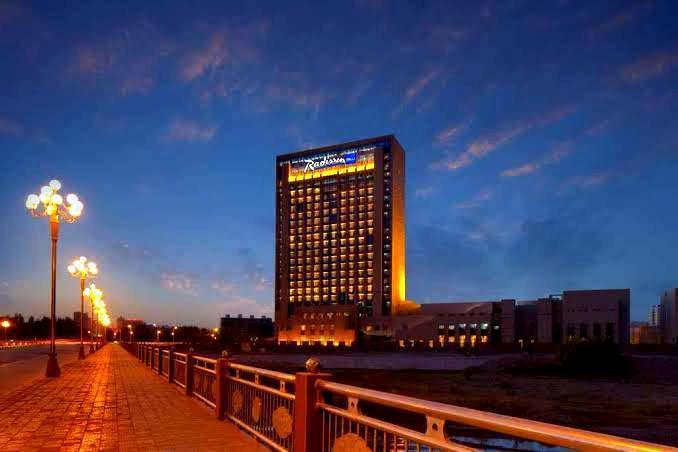
Declared Pamir out-and-back and frontier check · Karakul Lake approved viewpoint · Bazar at Radisson Blu Kashgar breakfast
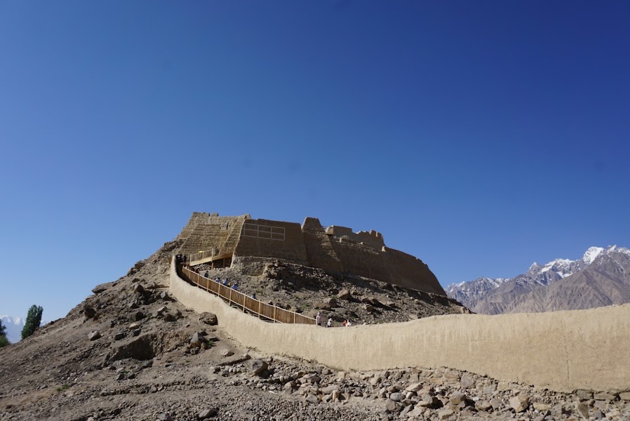
Day 3Tashkurgan acclimatization and heritage day
Stone City and Golden Grasslands · Low-exertion acclimatization afternoon · Xunyangpinwei Restaurant
Day 4Tashkurgan to Kashgar — explicit return from the Pamir excursion
Baisha Lake permitted viewpoint · Return to Kashgar and health reassessment · Operator-confirmed Tashkurgan hotel breakfast and road lunch
Day 5Kashgar to Yecheng — the G219 gateway
Yecheng G219 gateway orientation · Final frontier manifest and medical check · Operator-booked Kashgar–Yecheng meals
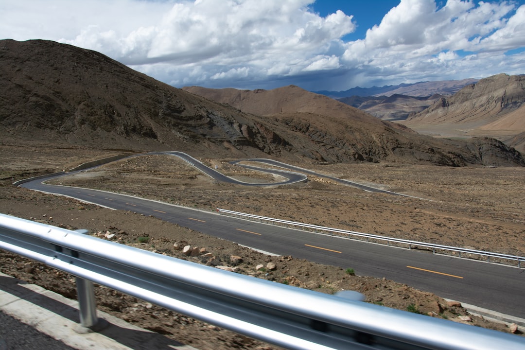
Day 6Yecheng to the operator-approved first G219 high-road stage
Mazar and Kudi corridor viewpoints · Conservative ascent protocol · Operator-booked Yecheng high-road stage meals
Day 7First high-road stage to Dahongliutan
Karakoram and Kunlun high-pass corridor · Arrival health screening at Dahongliutan · Operator-booked Dahongliutan meals
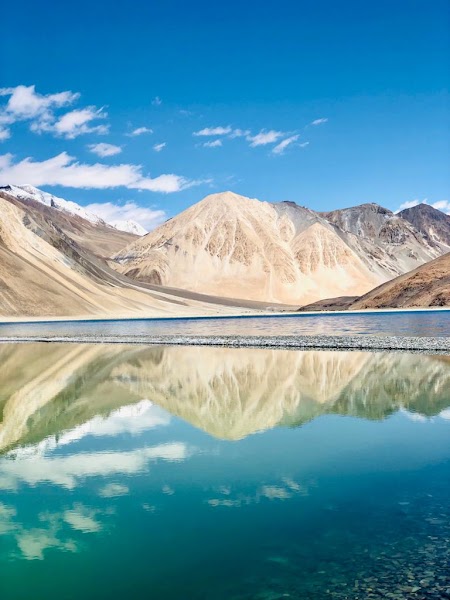
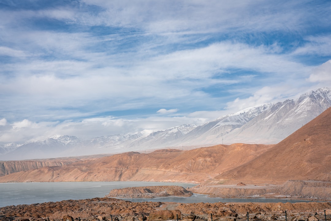
Day 8Dahongliutan to Rutog and Bangong Tso
Jieshan Daban and western plateau crossing · First Bangong Tso viewpoint · Operator-booked Dahongliutan–Rutog meals
Day 9Rutog and Bangong Tso to Shiquanhe
Bangong Tso morning viewpoint · Rutog rock-art or cultural stop if authorized · Operator-booked Rutog–Shiquanhe meals
Day 10Shiquanhe and Gar recovery day
Medically necessary low-exertion recovery · Operator-verified Ngari cultural visit · Operator-booked Shiquanhe recovery day meals
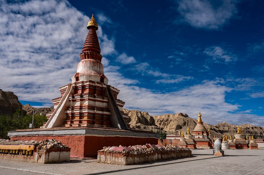
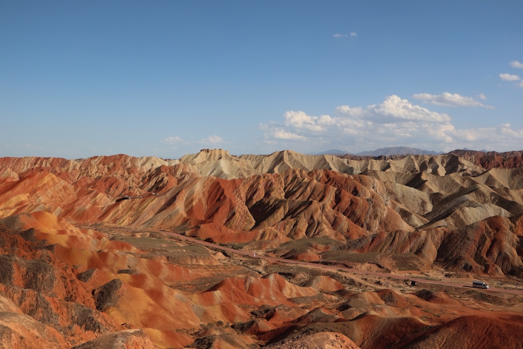
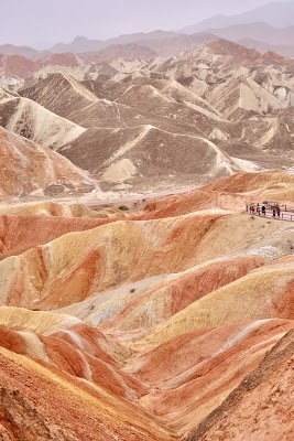
Day 11Shiquanhe to Zanda earth forest and Tholing
Zanda earth-forest approved viewpoints · Tholing Monastery orientation · Operator-booked Shiquanhe–Zanda meals
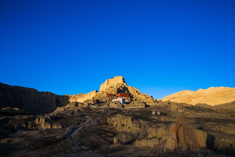
Day 12Zanda, Tholing Monastery, and Guge Kingdom ruins
Tholing Monastery · Guge Kingdom ruins · Operator-booked Zanda heritage day meals
Day 13Zanda to Shiquanhe
Zanda canyon geology route · Shiquanhe recovery and health review · Operator-booked Zanda–Shiquanhe return meals
Day 14Shiquanhe to Darchen and the Kailash region
Ngari plateau and sacred-landscape approach · Tirthapuri visit only if approved · Operator-booked Shiquanhe–Darchen meals
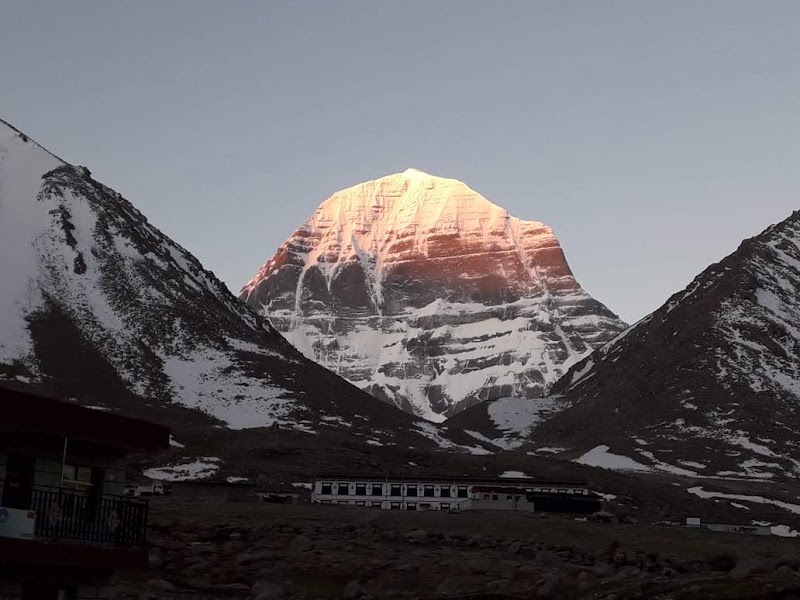
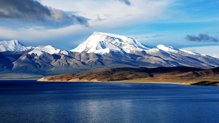
Day 15Mount Kailash sacred-landscape viewpoints from Darchen
Tarboche and operator-approved Kailash viewpoint · Darchen pilgrimage-context walk · Operator-booked Darchen sacred-landscape day meals
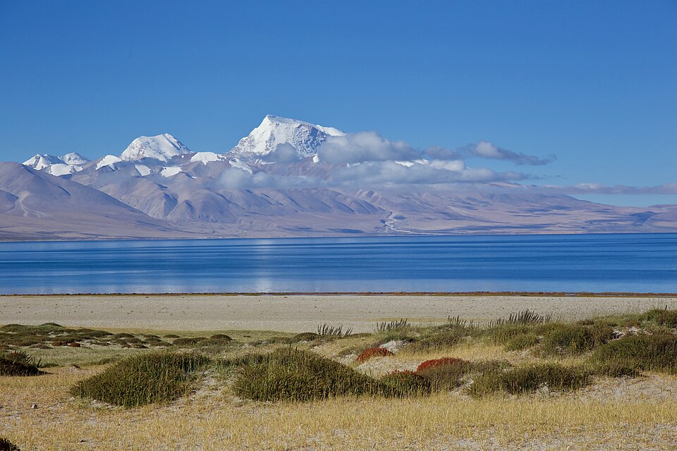
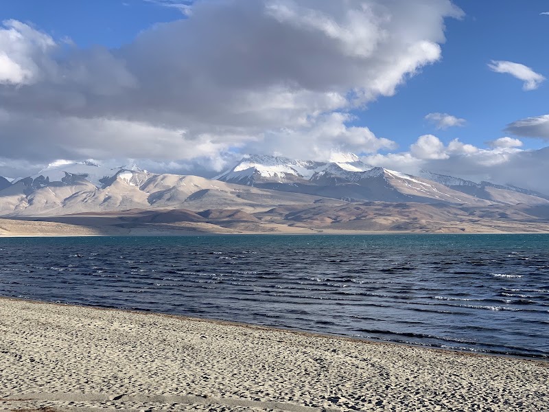
Day 16Lake Manasarovar and Rakshastal to the operator-set eastbound stage
Lake Manasarovar designated viewpoint · Rakshastal viewpoint · Operator-booked Manasarovar–eastbound stage meals
Day 17Operator-set eastbound stage to Saga
Western Tibetan plateau and river viewpoints · Saga arrival and symptom review · Operator-booked eastbound stage–Saga meals
Day 18Saga to Lhatse — completion of the classic G219 section
Brahmaputra headwaters and plateau viewpoints · Lhatse G219–G318 junction finish · Operator-booked Saga–Lhatse meals
Day 19Lhatse to Sakya Monastery and formal expedition finish
Sakya Monastery · Driver, guide, and onward-transfer handoff · Operator-booked Lhatse–Sakya finish meals
Stops along the route

Things to Do
Show 4 more
Where to Eat


Nearby and similar drives
Frequently asked questions
How long is the G219 Kashgar–Lhatse Managed Expedition drive?
The G219 Kashgar–Lhatse Managed Expedition covers About 3,200 km including the declared Pamir out-and-back from start to finish.
How long does the G219 Kashgar–Lhatse Managed Expedition take to drive?
Most travellers spend 19 days on the G219 Kashgar–Lhatse Managed Expedition, depending on stops and pace.
When is the best time to drive the G219 Kashgar–Lhatse Managed Expedition?
The recommended season for the G219 Kashgar–Lhatse Managed Expedition is June-September.
Where does the G219 Kashgar–Lhatse Managed Expedition start and end?
The G219 Kashgar–Lhatse Managed Expedition runs from Kashgar to Sakya Monastery finish.
What are the main stops on the G219 Kashgar–Lhatse Managed Expedition?
The G219 Kashgar–Lhatse Managed Expedition passes through Kashgar, Karakul and Tashkurgan acclimatization loop, Yecheng G219 gateway.
How difficult is the G219 Kashgar–Lhatse Managed Expedition to drive?
The G219 Kashgar–Lhatse Managed Expedition is rated extreme and is best handled with 4wd only.
Do I need a 4WD for the G219 Kashgar–Lhatse Managed Expedition?
Yes — the G219 Kashgar–Lhatse Managed Expedition includes off-road or rough sections that require 4wd only.
Do I need a permit or border paperwork for the G219 Kashgar–Lhatse Managed Expedition?
Yes — the G219 Kashgar–Lhatse Managed Expedition requires permits, fees, or border paperwork. Plan ahead: This is a licensed, fully managed expedition for foreign visitors—not an independent rental-car itinerary and not a promise that the guest may drive. Before paying, have a Tibet-based agency confirm in writing the exact nationalities accepted, China visa prerequisites, Xinjiang frontier permissions, Tibet Travel Permit, Alien's Travel Permit, Ngari/Kailash military or border permissions, every overnight registration, the supplied 4WD and professional driver, Tibetan guide, checkpoint manifest, meals, oxygen and medical plan, rescue and evacuation contacts, and insurance valid above 5,000 m in all visited regions. Authorities can deny or alter access even after booking; the operator's approved itinerary and daily road, weather, health, checkpoint, fuel, and lodging information override these suggested legs. Days 2–4 are an explicitly separate Kashgar–Karakul–Tashkurgan acclimatization excursion with the return to Kashgar shown; Karakul is not presented as part of the westbound G219 sequence. The main highway begins through Yecheng. This plan includes only operator-approved viewpoints in the Kailash sacred landscape, not a multi-day kora; add at least three or four separately planned days only if the operator, permits, health assessment, season, and rescue plan support it. Acute mountain sickness, HACE, and HAPE are life-threatening: obtain appropriate medical advice before travel, ascend conservatively, report symptoms immediately, never use oxygen or medication to conceal deterioration, and descend or evacuate when the guide's medical protocol requires it. Expect passes above 5,000 m, sub-zero nights, strong UV, snow, flood, rockfall, sand, military delays, poor communications, and very long service gaps. All remote meals and safe water must be tied to the licensed operator and exact registered accommodation; no generic teahouse, noodle shop, market stall, fuel station, or airport café is promised.
How many fuel stops are needed on the G219 Kashgar–Lhatse Managed Expedition?
Plan around 5 refuels (or about 11 EV charges) along the G219 Kashgar–Lhatse Managed Expedition, based on its About 3,200 km including the declared Pamir out-and-back length.
Is the G219 Kashgar–Lhatse Managed Expedition safe to drive?
This is a licensed, fully managed expedition for foreign visitors—not an independent rental-car itinerary and not a promise that the guest may drive. Before paying, have a Tibet-based agency confirm in writing the exact nationalities accepted, China visa prerequisites, Xinjiang frontier permissions, Tibet Travel Permit, Alien's Travel Permit, Ngari/Kailash military or border permissions, every overnight registration, the supplied 4WD and professional driver, Tibetan guide, checkpoint manifest, meals, oxygen and medical plan, rescue and evacuation contacts, and insurance valid above 5,000 m in all visited regions. Authorities can deny or alter access even after booking; the operator's approved itinerary and daily road, weather, health, checkpoint, fuel, and lodging information override these suggested legs. Days 2–4 are an explicitly separate Kashgar–Karakul–Tashkurgan acclimatization excursion with the return to Kashgar shown; Karakul is not presented as part of the westbound G219 sequence. The main highway begins through Yecheng. This plan includes only operator-approved viewpoints in the Kailash sacred landscape, not a multi-day kora; add at least three or four separately planned days only if the operator, permits, health assessment, season, and rescue plan support it. Acute mountain sickness, HACE, and HAPE are life-threatening: obtain appropriate medical advice before travel, ascend conservatively, report symptoms immediately, never use oxygen or medication to conceal deterioration, and descend or evacuate when the guide's medical protocol requires it. Expect passes above 5,000 m, sub-zero nights, strong UV, snow, flood, rockfall, sand, military delays, poor communications, and very long service gaps. All remote meals and safe water must be tied to the licensed operator and exact registered accommodation; no generic teahouse, noodle shop, market stall, fuel station, or airport café is promised.
What scenic tier is the G219 Kashgar–Lhatse Managed Expedition?
The G219 Kashgar–Lhatse Managed Expedition is a legendary drive — The world's most extraordinary drives — once-in-a-lifetime road trips with cinematic scenery, legendary roads, and unmatched cultural depth.