Avenue of the Volcanoes — Ecuador — Scenic
South America

Avenue of the Volcanoes

Ecuador

Point-to-point
Quito Alausí

In short: Avenue of the Volcanoes is a about 450 km scenic road trip in Ecuador, typically driven over 5 days, best in June-September. Highlights: Quito, Latacunga, Cotopaxi National Park.

Distance
about 450 km
Duration
5 days
Best Season
June-September
IconicModerateScenicPermit requiredGuide recommended

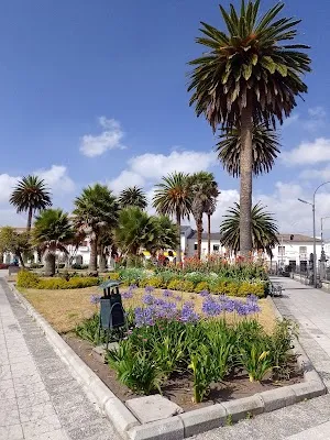
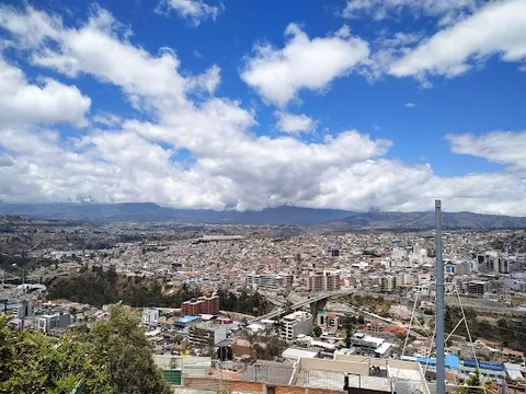
This classic Ecuadorian highland drive follows the spine of the Andes from Quito toward Chimborazo, linking a chain of volcanic peaks, market towns, and broad alpine valleys. Expect dramatic snowcapped summits, fertile farmland, and frequent roadside viewpoints in one of South America’s most iconic mountain corridors.

~0 refuels
~1 charge
Practical notes
Preregister where the protected area requires it and check the same-day IG-EPN bulletin plus Cotopaxi/Chimborazo park status, current entry/exit window and road/refuge restrictions. Add an easy acclimatization day after sea-level arrival; stop ascending and descend for altitude symptoms. Carry warm waterproof layers, sun protection and water, and use a lower-altitude alternative when high refuges, roads or visibility are restricted. Saquisilí market is day-specific and must be date-gated.

Make this route yours

Set your dates, pace, and taste, and RoadAtlas AI rebuilds this trip day by day with real, verified places.

Included with Traveler and Explorer plans.

Explore on the interactive map →

Plan this trip

Third-party planning links may be affiliate links. RoadAtlas stays independent, and you should verify details with the provider.

Day-by-day itinerary

Day 1Quito to Latacunga

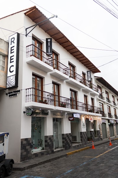
Historic Center of Quito · American Market at Hotel REEC

Day 2Latacunga and Cotopaxi National Park

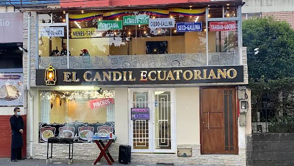
Cotopaxi National Park · Saquisilí Market · El Candil Latacunga

Day 3Ambato to Baños de Agua Santa

Pailon del Diablo · Leito's Bakery

Day 4Riobamba and Chimborazo Wildlife Reserve

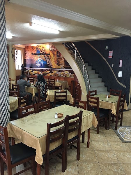
Chimborazo Wildlife Reserve · Restaurante Viento del Oeste

Day 5Riobamba to Alausí / current Devil’s Nose viewpoint

Devil's Nose Viewpoint · Confirmed Alausí hotel meal

Stops along the route
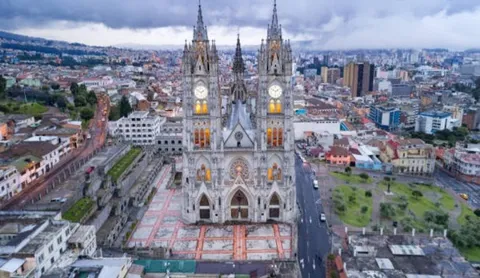
Quito — Departure — Avenue of the Volcanoes — Ecuador
Departure
Quito
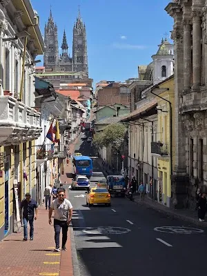
Start in Ecuador's high-altitude capital beneath surrounding volcanoes. Colonial plazas and Andean views set the tone fast.
Hotels
Latacunga — City — Avenue of the Volcanoes — Ecuador
City
Latacunga
A relaxed market town with easy access to Cotopaxi's lava-streaked slopes. Its old center is a handy stop for supplies and coffee.
Hotels
Ambato — City — Avenue of the Volcanoes — Ecuador
City
Ambato
A busy valley city known for flowers, fruit, and tree-lined avenues. It breaks up the drive with fuel, food, and services.
Hotels
Riobamba — City — Avenue of the Volcanoes — Ecuador
City
Riobamba
A broad highland city framed by distant peaks and fertile fields. It is a classic staging point for the southern volcano corridor.
Hotels
Alausí — Arrival — Avenue of the Volcanoes — Ecuador
Arrival
Alausí
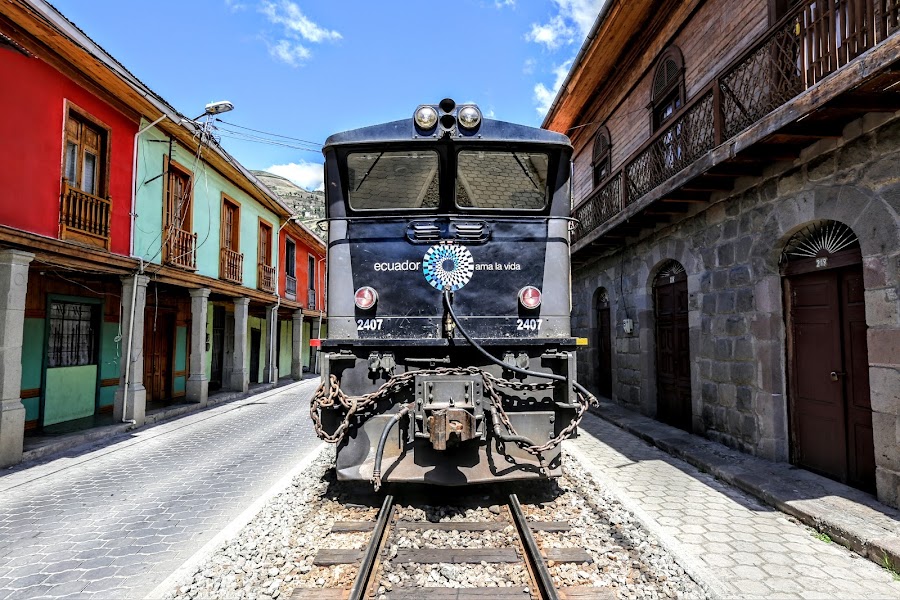
Use a separate southbound day for the railway heritage town and a current legal Devil’s Nose viewpoint.

Things to Do

Cotopaxi National Park — Nature — Avenue of the Volcanoes — Ecuador
Nature
Cotopaxi National Park
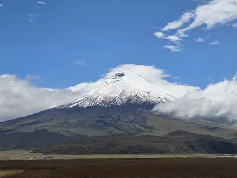
Ride past wide páramo, wild horses, and the near-perfect cone of Cotopaxi. Clear days bring some of the best volcano views in Ecuador.
Baños de Agua Santa — Landmark — Avenue of the Volcanoes — Ecuador
Landmark
Baños de Agua Santa
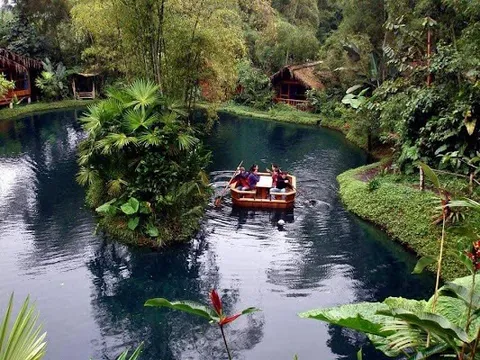
A lush adventure town tucked below the Andes. Waterfalls, hot springs, and canyon roads make it a favorite overnight stop.
Chimborazo Volcano — Nature — Avenue of the Volcanoes — Ecuador
Nature
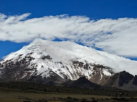
Chimborazo Volcano
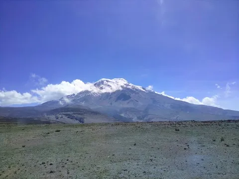
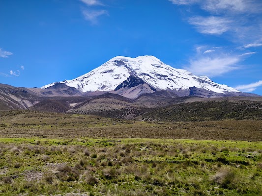
Finish at Ecuador's highest mountain and its stark glacier-ringed slopes. The final approach feels remote, windy, and unforgettable.
Historic Center of Quito — historic district — Avenue of the Volcanoes — Ecuador
historic district
Historic Center of Quito
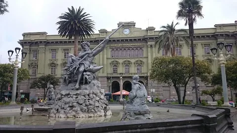
Walk the colonial core for churches, plazas, and hillside viewpoints. It is one of the best-preserved old towns in South America.
Cotopaxi National Park — national park — Avenue of the Volcanoes — Ecuador
national park
Cotopaxi National Park
Drive or hike among open grasslands with Cotopaxi looming overhead. Wildlife, crater views, and big skies define the experience.
Pailon del Diablo — waterfall — Avenue of the Volcanoes — Ecuador
waterfall
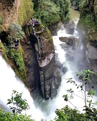
Pailon del Diablo
Hike to this thunderous waterfall near Baños for mist, bridges, and jungle scenery. It is one of the route's most famous stops.
Show 2 more
Devil's Nose Viewpoint — viewpoint — Avenue of the Volcanoes — Ecuador
viewpoint
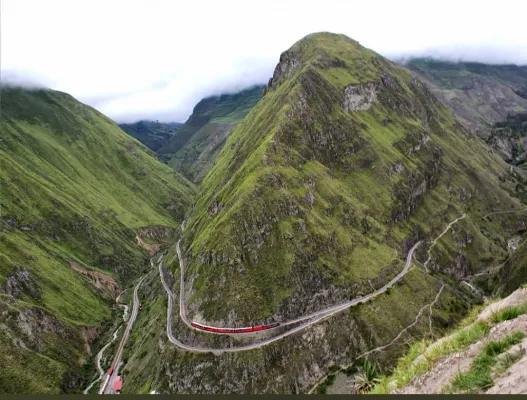
Devil's Nose Viewpoint
Pause for dramatic Andean views around one of Ecuador's most legendary rail and mountain sites. The landscape feels steep and historic.
Chimborazo Wildlife Reserve — nature reserve — Avenue of the Volcanoes — Ecuador
nature reserve
Chimborazo Wildlife Reserve
Explore the high-altitude reserve around Chimborazo for vicuñas and stark volcanic scenery. The thin air and open terrain make it memorable.

Where to Eat

Saquisilí Market — Food & Drink — Avenue of the Volcanoes — Ecuador
Food & Drink
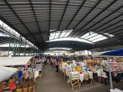
Saquisilí Market
A lively highland market with colorful produce, textiles, and street snacks. It is one of the best places to feel local Andean life.
American Market at Hotel REEC — Ecuadorian and international — Avenue of the Volcanoes — Ecuador
Ecuadorian and international
American Market at Hotel REEC
First-party Latacunga hotel restaurant serving lunch and dinner near the historic centre; reserve directly.
El Candil Latacunga — Ecuadorian — Avenue of the Volcanoes — Ecuador
Ecuadorian
El Candil Latacunga
Named Latacunga meal retained on the Cotopaxi-base day; reconfirm address and hours before departure.
Leito's Bakery — Bakery, coffee — Avenue of the Volcanoes — Ecuador
Bakery, coffee
Leito's Bakery
A dependable Baños bakery for coffee, bread, and pastries on the road. It is an easy place to refuel before more canyon driving.
Restaurante Viento del Oeste — Chimborazo regional — Avenue of the Volcanoes — Ecuador
Chimborazo regional
Restaurante Viento del Oeste
Municipal-tourism-listed Riobamba restaurant with a published address, evening hours and booking contact.
Café Hood — Cafe, international — Avenue of the Volcanoes — Ecuador
Cafe, international
Café Hood
Named Baños café on the correct overnight; reconfirm its current service before relying on it.

Nearby and similar drives

Frequently asked questions

How long is the Avenue of the Volcanoes drive?

The Avenue of the Volcanoes covers about 450 km from start to finish.

How long does the Avenue of the Volcanoes take to drive?

Most travellers spend 5 days on the Avenue of the Volcanoes, depending on stops and pace.

When is the best time to drive the Avenue of the Volcanoes?

The recommended season for the Avenue of the Volcanoes is June-September.

Where does the Avenue of the Volcanoes start and end?

The Avenue of the Volcanoes runs from Quito to Alausí.

What are the main stops on the Avenue of the Volcanoes?

The Avenue of the Volcanoes passes through Quito, Latacunga, Cotopaxi National Park.

How difficult is the Avenue of the Volcanoes to drive?

The Avenue of the Volcanoes is rated moderate and is best handled with any vehicle.

Can I drive the Avenue of the Volcanoes in a regular car?

Yes — the Avenue of the Volcanoes is paved end-to-end and a regular car is fine in normal conditions.

Do I need a permit or border paperwork for the Avenue of the Volcanoes?

Yes — the Avenue of the Volcanoes requires permits, fees, or border paperwork. Plan ahead: Preregister where the protected area requires it and check the same-day IG-EPN bulletin plus Cotopaxi/Chimborazo park status, current entry/exit window and road/refuge restrictions. Add an easy acclimatization day after sea-level arrival; stop ascending and descend for altitude symptoms. Carry warm waterproof layers, sun protection and water, and use a lower-altitude alternative when high refuges, roads or visibility are restricted. Saquisilí market is day-specific and must be date-gated.

How many fuel stops are needed on the Avenue of the Volcanoes?

Plan around 0 refuels (or about 1 EV charges) along the Avenue of the Volcanoes, based on its about 450 km length.

Is the Avenue of the Volcanoes safe to drive?

Preregister where the protected area requires it and check the same-day IG-EPN bulletin plus Cotopaxi/Chimborazo park status, current entry/exit window and road/refuge restrictions. Add an easy acclimatization day after sea-level arrival; stop ascending and descend for altitude symptoms. Carry warm waterproof layers, sun protection and water, and use a lower-altitude alternative when high refuges, roads or visibility are restricted. Saquisilí market is day-specific and must be date-gated.

What scenic tier is the Avenue of the Volcanoes?

The Avenue of the Volcanoes is a iconic drive — Iconic road trips that anchor a region's reputation — postcard scenery, headline highways, and the routes most travellers want to drive.