The Wild Atlantic Way is the world's longest defined coastal route, 2,500 km down the entire western seaboard of Ireland. Driving the whole thing well takes 10 to 14 days, but a focused week from Donegal to Kerry captures the signature cliffs, islands, and harbour towns. The best months are May to September, when the days are long and the pubs are full of music.
This guide lays out how much time you actually need, a stop-by-stop highlights itinerary, and honest advice on weather, driving, and when to go.
How long do you need on the Wild Atlantic Way?
The full route runs 2,500 km, so the catalog time of 10 to 14 days is realistic if you want to reach every headland from Malin Head in the north to Kinsale in the south. Most visitors do not have two weeks, and that is fine. The west coast rewards a slower pace on a shorter stretch far more than a rushed dash along the whole thing.
A practical plan is to pick one direction and one anchor region. A week is enough to link the greatest hits: the cliffs of Donegal, the islands of Mayo, the Cliffs of Moher in Clare, and the two great peninsulas of Kerry. Drive north to south and you finish in the mild, green southwest, the most scenic finale on the coast.
The best-of-the-west 7-day itinerary
This route strings together the standout stops in the catalog, driving from the top of Donegal down to Killarney. Distances are short each day, but the roads are narrow and slow, so leave plenty of time.
Day 1: Malin Head and Donegal
Start at Malin Head, Ireland's most northerly point, a wind-scoured headland where a battered signal tower faces the open Atlantic. Work south through Donegal's quiet lanes and stone-walled fields toward Donegal Town for the night.
Day 2: Slieve League
Give a full morning to Slieve League, Europe's highest accessible sea cliffs at 601 m, three times the height of the more famous Cliffs of Moher and almost free of crowds and fences. The cliff-edge One Man's Path is not for the faint of heart. Continue south to Sligo.
Day 3: Achill Island and Westport
Cross the bridge to Achill Island, Ireland's largest island, where Keem Bay's horseshoe of white sand backed by towering cliffs is the most beautiful beach in the country. Sleep in Westport, a Georgian planned town on island-studded Clew Bay, with the holy pilgrimage mountain of Croagh Patrick on the skyline.
Day 4: Connemara to Galway
Drive the wild bogland and coast of Connemara down to Galway city, the cultural heart of the west, for a night of seafood and traditional sessions.
Day 5: Cliffs of Moher
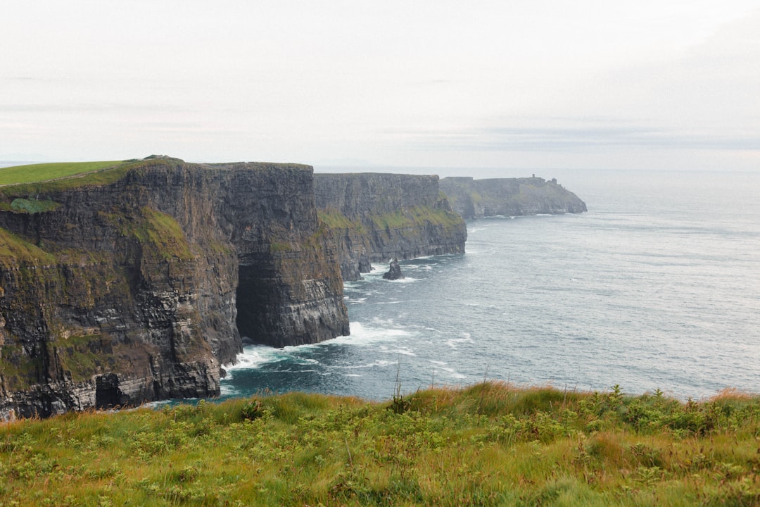
Head into County Clare for the Cliffs of Moher, eight kilometres of 200 m vertical Atlantic sea cliffs and the defining image of the Irish coast. Walk the path beyond O'Brien's Tower to leave the coach crowds behind. Base yourself in the music village of Doolin.
Day 6: Dingle Peninsula
Loop the Dingle Peninsula on the Slea Head Drive, past beehive huts, Iron Age forts, and sheer sea views around Ireland's westernmost point. It is the finest short coastal circuit in the country. Overnight in Dingle town.
Day 7: Ring of Kerry
Finish on the Ring of Kerry, the classic circuit of the Iveragh Peninsula that takes in MacGillycuddy's Reeks, ancient stone forts, and offshore views of the monastic rock of Skellig Michael. Killarney is the natural base for the last night.
Signature stops at a glance
| Stop | Region | Why it matters | Time to allow |
|---|---|---|---|
| Malin Head | Donegal | Ireland's northernmost point | 1 to 2 hours |
| Slieve League | Donegal | Europe's highest accessible sea cliffs | Half day |
| Achill Island | Mayo | Keem Bay, the finest beach on the coast | Half day |
| Cliffs of Moher | Clare | The defining image of the Irish coast | Half day |
| Dingle Peninsula | Kerry | Slea Head Drive, the best short loop | Full day |
| Ring of Kerry | Kerry | 179 km circuit of the Iveragh Peninsula | Full day |
When is the best time to drive it?
The catalog season is May to September, and for good reason. Those months bring the longest daylight, the warmest sea air, and the greatest chance of clear cliff views. June and September are the sweet spot, with fewer crowds than peak July and August but still reliable ferries and open visitor centres.
Atlantic weather changes fast in every month. Expect fog, crosswinds, and wet surfaces even in summer, and be ready to swap a planned cliff walk for a pub afternoon when the rain sets in. Some cliff paths, ferries, and minor coastal spurs can close after heavy rain or high winds, so check local conditions before committing to a detour.
What car do you need, and how should you drive it?
The Wild Atlantic Way is mostly on public roads and a standard car is fine, so any vehicle works. The route is also EV friendly, with a growing charging network along the coast. The real skill is not the car but the driving: narrow lanes, stone walls, sheep, and frequent passing places demand patience and a steady speed.
Two rules make the whole coast easier. Start early to beat the coaches at the marquee stops, and never rush a narrow section to make up time. The scenery is the point, and the slow roads are part of it.
How does it compare to Scotland's coastal loop?
If you are weighing Ireland's west against the North Coast 500, the difference is scale and character. The North Coast 500 is a tight 500 km Highland loop you can do in five to seven days, while the Wild Atlantic Way is five times longer and built for a slower, region-by-region approach. Both are top-tier scenic drives, so the choice comes down to how much time you have and whether you want cliffs and Gaelic culture or Highland glens and single-track passes.
Frequently asked questions
How many days do you need for the Wild Atlantic Way?
Ten to 14 days covers the full 2,500 km from Donegal to west Cork. If you have a week, focus on the highlights from Malin Head down to Kerry rather than trying to drive the entire coast.
Which direction should you drive the Wild Atlantic Way?
North to south is the classic choice. You finish in the mild, green southwest around Kerry and Cork, saving the softest and arguably most beautiful scenery for last.
When is the best time to drive the Wild Atlantic Way?
May to September, with June and September offering the best balance of long days, open services, and thinner crowds. Atlantic weather is changeable in every season, so build in flexible days.
Is the Wild Atlantic Way worth it?
Yes. It is the world's longest defined coastal route and packs in Europe's highest accessible sea cliffs, the country's best beaches, and living Gaelic culture. Even a single week on the coast is one of the great drives in Europe.
Can you drive the Ring of Kerry as part of the trip?
The Ring of Kerry is a 179 km loop of the Iveragh Peninsula and slots neatly into the southern end of the route as a full day out from Killarney.
Ready to plan your own run down Ireland's west coast? See the full Wild Atlantic Way route guide for stops and advisories, and open the interactive map to chart your days from Donegal to Kerry.