The Shimanami Kaidō runs 70 km from Onomichi in Hiroshima to Imabari in Ehime, island-hopping across the Seto Inland Sea on a chain of six bridges, and October falls squarely in its best driving season. Give the crossing one day if you want the bridges and a couple of stops, or two if you want to walk the islands rather than just pass over them.
Most people know the Shimanami Kaidō as a cycling route, the one with the blue line painted along the shoulder. It is also a short, easy drive that any car can manage, fully paved the whole way, and the stretch that stays with you is the run over the Kurushima straits into Imabari. Driving it works differently from riding it, and the stops take a little planning.
The Shimanami Kaidō at a glance
The route links six islands of the Seto Inland Sea, Mukaishima, Innoshima, Ikuchijima, Omishima, Hakatajima and Oshima, between the port of Onomichi on the Hiroshima side and the towel town of Imabari in Ehime. The driving spine is the Nishiseto Expressway, which carries you over each bridge. You drop off at island interchanges to reach the temples, shrines and viewpoints, then climb back on.
- Distance: 70 km for the direct crossing, longer once you add island detours
- Time needed: 1 to 2 days
- Difficulty: easy, paved throughout, any vehicle
- Best season: April to June and September to November
- EV-friendly: yes
The 70 km figure is the straight bridge-to-bridge run. Every worthwhile stop sits off the expressway, so the day you actually drive is longer and slower than the number suggests.
How many days do you need?
| Plan | What you fit | Best for |
|---|---|---|
| One day | Onomichi ramen, Kosanji Temple, Kirosan at sunset, Imabari | A scenic crossing on a schedule |
| Two days | All of the above plus Oyamazumi Shrine, Hakata's beach, slow island time | A proper island trip |
One day gets you across with the headline stops. Two days is the honest answer if you want the islands themselves: the quiet beach on Hakata, the armour hall on Omishima, an unhurried seafood lunch over the water. If you only have a day, drive it south from Onomichi so you finish at Kirosan near sunset with the whole bridge chain behind you.
The best stops, island by island
Onomichi, the Hiroshima gateway
Start in Onomichi, where hillside temples and narrow cat-alley lanes drop towards the water. Climb to Senkō-ji Temple for the view back over the strait, then have a bowl of Onomichi ramen, the local soy broth heavy with pork-back fat, at a counter like Tsutafuji. Go before the lunch rush and check the day it closes, since the old counters keep their own hours.
Innoshima and the pirate castle
On Innoshima, the hilltop Suigun Castle recalls the Murakami, the pirate clans who ran these straits for centuries and taxed every ship that passed below. It is a short climb for a long view down the island chain, and a useful bit of context before the bridges start to blur together.
Setoda on Ikuchijima
Setoda is the stop for Kosanji Temple, a florid private complex an industrialist built in memory of his mother. Above it, the Hill of Hope rises in white marble over the Seto Sea, an all-marble folly carved and polished until the whole hilltop gleams. It is the one place on the route where the view is entirely man-made.
Omishima and Oyamazumi Shrine
Cross the long cable-stayed Tatara Bridge to Omishima and Oyamazumi Shrine, Japan's foremost warrior shrine, which holds the largest collection of samurai armour in the country under ancient camphor trees. The roadside station at Tatara Shimanami Park, right under the bridge, serves Setouchi seafood bowls with the span in view, so it doubles as the natural lunch stop halfway across.
Hakata and Oshima
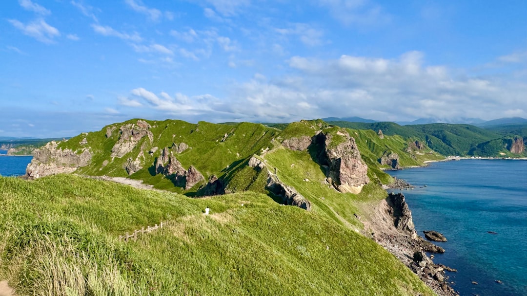
Hakatajima is the quiet one, with orange orchards, a three-kilometre sand beach, and long stretches of almost empty road. Then comes Oshima and the climb to Kirosan Observatory on Mount Kirosan, the best single view on the whole route, the full chain of bridges laid out behind you and the Kurushima straits ahead. Time it for late afternoon. Near the last bridge, Yoshiumi Ikiikikan plates up local sea bream and Setouchi seafood.
Imabari, the Ehime finish
The run ends over the Kurushima Kaikyō bridges, a long triple suspension span across fast tidal water, into Imabari. The town is known for its towels and for a seaside castle whose moat fills and empties with the tide. It is a calm, low-key place to spend the night if you have driven down slowly over two days.
How driving differs from the bike route
The blue line painted along the shoulder is the cycling course. It leaves the expressway, uses local roads and ramps, and sometimes runs on bicycle-only approaches, so a car cannot follow it. Drivers stay on the Nishiseto Expressway and exit at the island interchange for each stop, Kosanji on Ikuchijima, Oyamazumi and Tatara Park on Omishima, Kirosan on Oshima, then rejoin. Miss an exit and the next place to turn around can be a full bridge away.
The bridge approaches are open and catch the wind, and busy weekends bring cyclists and parking queues onto the islands, so check the official Shimanami road map, the tolls and the forecast before you set off. The driving itself is gentle. The planning is knowing which interchange goes with which stop.
When to drive the Shimanami Kaidō
The season runs April to June and again September to November, which puts October among the best weeks of the year to go. Autumn brings clear light over the water and the islands' citrus season, without the heat haze of midsummer or the cold winds that funnel through the straits in winter. Weekends draw the biggest cycling crowds, so a weekday drive is calmer at the viewpoints and easier to park.
Frequently asked questions
How long is the Shimanami Kaidō drive?
The direct crossing is 70 km from Onomichi to Imabari, which you can drive in a day with a few stops. The stops all sit off the expressway, though, so two days is the realistic way to explore the islands properly.
Can you drive the Shimanami Kaidō, or is it only for cyclists?
You can drive it. The route is fully paved and rated easy, and any car or EV can make the crossing on the Nishiseto Expressway. The blue line on the shoulder is the cycling course, so drivers exit at the island interchanges to reach each stop instead of following the painted line.
What are the best stops on the Shimanami Kaidō?
Onomichi for ramen and the Senkō-ji view, Innoshima's Suigun pirate castle, Kosanji Temple at Setoda, Oyamazumi Shrine and its armour hall on Omishima, and the Kirosan Observatory on Oshima for the view back along the bridges. Finish in Imabari at its tidal-moat castle.
When is the best time to drive the Shimanami Kaidō?
April to June and September to November, when the weather over the Seto Inland Sea is mildest and clearest. October is a strong choice. Drive on a weekday if you can, since weekends bring the heaviest cycling traffic and the longest parking queues.
Is the Shimanami Kaidō hard to drive?
No. It is rated easy and paved the whole way, so the only real care needed is the wind on the exposed bridge approaches and exiting at the correct interchange for each island stop. Missing an exit can mean a long detour to the next island before you can turn back.
Plan your drive
See the full Shimanami Kaidō route guide for every island in order, line it up with more scenic coastal drives around the world, or pair it with a mainland loop like Japan's Golden Route. When you have your stops in mind, build the drive on the interactive map.