The drive to Milford Sound runs about 120 km each way from Te Anau, and you should budget at least four hours in each direction once you allow for stops. The road climbs the Eglinton Valley, threads the single-lane Homer Tunnel under the Darran Mountains, and drops to a 16 km fjord where Mitre Peak rises straight out of the water. It is open and at its most reliable from November to April. Here is where to stop, when to go, and how to drive it without getting caught out.
The Milford Road at a glance
The Milford Sound drive is the only road into Fiordland's most famous fjord, and it starts in Te Anau on the shore of New Zealand's second-largest lake. From there it follows the lake north, runs the length of the Eglinton Valley, climbs to The Divide, and burrows through the Homer Tunnel before the final descent to the water. Most people drive out and back in a single long day, or split it over two with a Te Anau night and an early start.
- Distance: about 240 km return, roughly 120 km each way
- Duration: allow at least four hours one way with stops, so plan a full day
- Best season: November to April
- Difficulty: moderate, on a sealed public road with one single-lane tunnel
- EV friendly: yes, though you should charge in Te Anau before you leave
There is no reliable mobile coverage past Te Anau, and no fuel or grocery shopping at Milford itself. Fill the tank, pack lunch and water, and carry warm waterproof layers whatever the forecast says.
The best stops from Te Anau to Milford Sound
Drive out in the morning to reach the fjord before the tour coaches, and save the roadside stops for the return when the light is lower and the car parks have emptied. This is how the road unfolds heading north.
| Stop | What it is | Why stop |
|---|---|---|
| Te Anau | Lakeside gateway town | Last fuel, food, and phone signal |
| Eglinton Valley | Glacial valley of beech and tussock | Wide flats under the Earl and Livingstone ranges |
| Mirror Lakes | Roadside reflecting pools | Still-water reflections of the Earl Mountains |
| The Divide | Lowest pass in the Southern Alps, 532 m | Routeburn trailhead and the shift into Fiordland |
| Homer Tunnel | 1.2 km single-lane tunnel | Kea at the portal, then a steep descent |
| Milford Sound | 16 km fjord under 1,200 m walls | Mitre Peak, boat cruises, dawn kayaking |
Te Anau
Te Anau sits on the eastern shore of its namesake lake and works as the base for everything in southern Fiordland. It has the last fuel and the last real supermarket before Milford, so treat it as your staging point. If you have an evening spare, the glowworm caves across the lake run by boat after dark and make a good use of the hours before an early road start.
Eglinton Valley
North of the lake the road opens into the Eglinton Valley, a broad U carved by ice and floored with beech forest and golden tussock. The Earl and Livingstone ranges rise steeply on either side, and the river runs slow and clear beside the tarmac. It is the first stretch where you feel the scale of Fiordland, and it rarely holds a crowd.
Mirror Lakes
A short boardwalk leads to a set of small roadside lakes that reflect the Earl Mountains when the water is calm. Come at dawn, before the wind gets up and before the coaches arrive, and the reflection is close to perfect with only birdsong for company. It takes ten minutes and repays them.
The Divide
At 532 m, The Divide is the lowest pass across the Southern Alps and the point where the country changes. Tussock plateau gives way to hanging valleys and dripping rainforest, and the walk to Key Summit branches off here at the start of the Routeburn Track. Even without hiking, it is worth pulling in to feel the air turn cooler and wetter.
Homer Tunnel
The 1.2 km Homer Tunnel is bored straight through the Darran Mountains, unlit, dripping, and steep enough to feel it in your ears. It runs single-lane with traffic lights at the portals in the busy months, so expect a short wait. The kea, New Zealand's alpine parrots, gather at the entrance and will happily strip the rubber from your wipers if you leave the car, so keep windows up and food out of sight.
Milford Sound
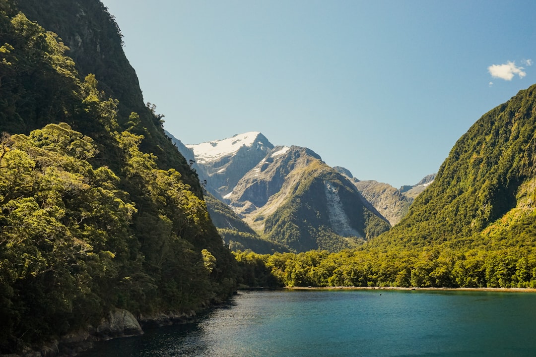
Beyond the tunnel the road drops fast to sea level and the fjord opens ahead, 16 km of dark water walled by cliffs that climb 1,200 m, with Mitre Peak standing sheer at the head of it. A boat cruise is the standard way to see the far reaches and the waterfalls, and kayaking at first light gets you onto the water almost alone. Book the cruise ahead and use its check-in time as the fixed point your whole day plans around.
When to drive the Milford Road
November to April is the reliable window. Through the New Zealand summer the road is open, the walks are clear, and the daylight is long enough to drive out, cruise, and return without rushing. Fiordland is one of the wettest places on earth, so rain is likely at any time; a wet day fills the cliffs with temporary waterfalls and is worth driving for rather than avoiding.
Outside summer the picture changes. Winter brings snow, avalanche risk, and rockfall, and the road authority can require chains or close the pass entirely for avalanche control with little notice. Flooding can shut it in any season. Check the NZTA Journey Planner for the live Milford Road status the morning you travel, and again if heavy rain moves in, then build your day around the cruise time so a tunnel queue or a slow stretch does not cost you the boat.
For a longer Fiordland trip, the drive pairs naturally with the Southern Alps Highway north to the glaciers, or the Pacific Coast Highway on the North Island if you are working the whole country. You can map all three and their stops on the interactive route map.
Frequently asked questions
How long is the drive from Te Anau to Milford Sound?
It is about 120 km each way, and you should allow at least four hours one way once you factor in the roadside stops, the tunnel queue, and the slow final descent. Plan a full day for the return trip.
Can you drive to Milford Sound yourself without a tour?
Yes. The Milford Road is a public sealed road and is not booked, so you can self-drive out from Te Anau and join a boat cruise at the fjord. Only the road itself can close, for weather or avalanche control, so check its status before you set off.
Is there fuel or a shop at Milford Sound?
No. There is no reliable fuel or grocery shopping at Milford, and no dependable mobile coverage past Te Anau. Fill up, buy food and water, and download offline maps in Te Anau before you leave.
When is the Milford Road open?
It is most reliably open from November to April. In winter it can require chains or close for snow, avalanche, or rockfall, and flooding can shut it in any season, so always check the NZTA Journey Planner on the day.
Do you need a four-wheel drive for the Milford Road?
No. The road is sealed the whole way and any vehicle can drive it in summer. In winter you may need to carry chains, and you should follow the road authority's requirements before heading up to the Homer Tunnel.
Read the full Milford Sound route guide for the stop-by-stop breakdown, then plot your own version on the interactive map.