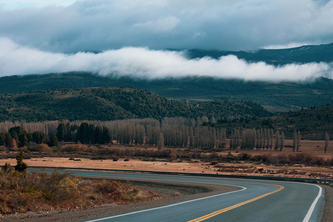
The Carretera Austral runs 1,240 km down Chile's Ruta 7, from Puerto Montt to the road's dead end at Villa O'Higgins, and 12 to 14 days is the right length to drive it without rushing the ferries. Much of it is gravel, cut through Patagonian fjords and temperate rainforest, so this is a plan built around ferry timetables, fuel stops, and weather rather than daily mileage.
Below is a stop-by-stop itinerary for a southbound run, with the real distances and the crossings you have to book ahead. Read the full Carretera Austral route guide before you commit, then plot the whole line on the interactive map.
The route at a glance
The drive splits into three sections divided by the ferries that stitch the road together across water it cannot bridge.
| Section | Days | Overnights | Signature stop |
|---|---|---|---|
| North: fjords and rainforest | 1 to 4 | Hornopirén, Chaitén, Puyuhuapi | Ventisquero Colgante, Queulat |
| Middle: Coyhaique and the lake | 5 to 8 | Coyhaique, Puerto Río Tranquilo | Capillas de Mármol |
| South: the road's end | 9 to 12 | Cochrane, Caleta Tortel, Villa O'Higgins | Villa O'Higgins |
Total driving is 1,240 km over gravel and paved stretches, plus three ferry sequences. The route is rated hard and wants an SUV.
Days 1 to 4: Puerto Montt to Puyuhuapi
Start in Puerto Montt, the last large city before the deep south. The fish market at Angelmó harbour is the best meal in town and a fair farewell to pavement and cell signal. Drive south to Hornopirén and overnight there before the northern ferry sequence.
This is the stretch that needs booking discipline. The Hornopirén to Leptepu and Fiordo Largo to Caleta Gonzalo vehicle ferries run through Somarco, and you reserve them ahead, then reconfirm the same day you sail. Download your tickets and Pases Parques while you still have signal.
The ferries land you in Parque Pumalín, which protects the world's southernmost temperate rainforest. The alerce trees here pass 3,000 years in age. Check the park's trail-entry cutoffs before you set off, since they change with the season. Nearby, Volcán Chaitén erupted in 2008 after 9,000 years dormant and half-buried the town in ash; the lava dome still steams above the ruined streets. Overnight in Chaitén.
Carry on to Puyuhuapi, a village founded by German settlers on a fjord. The thermal pools at Termas de Puyuhuapi are reached only by boat, which keeps them quiet. Just south, Queulat National Park holds the Ventisquero Colgante, a hanging glacier that calves ice straight into a turquoise lake below.
Days 5 to 8: Coyhaique and the Marble Caves
Coyhaique is the only real town on the Carretera Austral and the place to resupply, refuel, and do laundry. It is the fly-fishing capital of South America, with the clear Río Simpson running through the centre. Give it a night, then push south to Puerto Río Tranquilo on the shore of Lago General Carrera.
From Río Tranquilo, take the boat tour to the Capillas de Mármol, marble caves that glacial meltwater has sculpted over centuries on water of an unreal turquoise. Weather runs the boats, so keep a spare morning in case the lake is too rough to sail.
Days 9 to 12: Cochrane to the end of the road
Cochrane is the supply base for Patagonia National Park, in the Valle Chacabuco, where a signed circuit fills a good day of hiking. Beyond it the road empties out. Overnight in Caleta Tortel, a settlement of cypress boardwalks with no streets, before the Puerto Yungay to Río Bravo crossing. That one is a separate subsidized Fiordo Mitchell service, not a Somarco booking, so check the current official timetable and boarding rule rather than assuming a reservation.
Past Río Bravo the last leg runs to Villa O'Higgins, where the Carretera Austral simply stops. Wild Patagonia stretches south with no road to follow. Pick an open, signed local trail for the final day; the glacier boat outings from here are separate licensed products that need their own weather window.
When to drive the Carretera Austral
Drive it between November and March, the Patagonian summer, when the ferries run their full schedules and the passes and trails stay open. Outside those months, crossings thin out and weather closes more of the route. Even in summer, plan for rain on the fjord side and check road status, landslides, and fuel daily.
What you need to prepare
The route is unpaved for long stretches and remote enough that self-sufficiency is the whole game.
- Book the Somarco ferries ahead and reconfirm the day you sail; treat Puerto Yungay to Río Bravo as its separate service.
- Carry offline maps, cash, food, water, a spare tyre, and a recovery kit.
- Reserve meals at each remote lodge or pack lunches rather than counting on roadside restaurants.
- Download the Pases Parques before the low-signal sections north of Chaitén.
For the wider region, the Salar de Uyuni Circuit in Bolivia and Argentina's Ruta 40 pair well with this drive, and both sit in our Adventure and Overland Routes collection.
Frequently asked questions
How many days do you need for the Carretera Austral?
Plan 12 to 14 days one way from Puerto Montt to Villa O'Higgins. That leaves room for the three ferry sequences, weather delays, and full days at Queulat, the Marble Caves, and Patagonia National Park.
Do you need a 4x4 for the Carretera Austral?
An SUV with good clearance is enough for the gravel and the ripio sections. The road is rated hard for its remoteness and surface rather than for technical off-road driving, so tyres, a spare, and a recovery kit matter more than low range.
When is the best time to drive the Carretera Austral?
November to March. The ferries keep full timetables, trails and passes stay open, and daylight is long. Book the vehicle ferries well ahead in the December to February peak.
Which ferries do you have to book on the Carretera Austral?
The Hornopirén to Leptepu and Fiordo Largo to Caleta Gonzalo crossings run through Somarco and need advance reservations plus same-day reconfirmation. The Puerto Yungay to Río Bravo crossing in the south is a separate subsidized service with its own timetable.
Open the full Carretera Austral route guide for the stop details, and plot your own version on the interactive map.