The Atlantic Ocean Road is best driven from late spring to early autumn, roughly late May through September, when the seas are calmest, the roadside kitchens and the Ergan museum in Bud are open, and the far-north daylight stretches close to around the clock. The road stays open all year, so the choice is really about conditions. Summer gives you bright, easy driving and settled water. Autumn and winter bring the storm seas the road is known for, when swells break over the bridges, and they ask a lot more of you.
The Atlantic Ocean Road, Atlanterhavsvegen, is a 36 km Norwegian Scenic Route on the Møre og Romsdal coast, running from Kårvåg across a chain of low islets and causeways to the fishing village of Bud. It is an easy drive in any car, and an easy one in an electric car. The bridges sit almost at sea level on an exposed edge of the Norwegian Sea, so what the water is doing decides how the day feels.
Is the Atlantic Ocean Road open all year?
Yes. Unlike Norway's mountain passes, which gate shut under snow, this is a low coastal road that carries traffic through every month. Storms are the only thing that closes it, and then only for a few hours at a time while waves and debris wash the carriageway. The regional roads authority posts live status on the 175 traffic service, and the official Norwegian Scenic Routes page links the same-day feed.
So pick your month by the conditions you want, not by whether the road is technically open. Summer brings long light and calm water. Late autumn and winter bring short days and a sea that throws itself over the tarmac.
The best months, compared
Here is how the year breaks down for this stretch of coast. Daylight figures are approximate for 63 degrees north in western Norway, and the sea state is a tendency, not a guarantee.
| Period | Sea and weather | Daylight | Crowds | Verdict |
|---|---|---|---|---|
| Late May | Cool, seas settling | About 18 hours | Light | Fresh and quiet, a strong opener |
| June | Mild, long calm spells | Up to 20 hours | Building | Endless light, few closures |
| July | Warmest, calmest water | About 18 hours | Heaviest | Best weather, most cars |
| August | Warm, still settled | About 15 hours | Heavy, easing late | The all-round sweet spot |
| September | Cooler, first swells | About 12 hours | Lighter | Quiet and moody, shorter days |
| October to winter | Storm swells, waves on the road | Under 6 hours by midwinter | Very few | Storm-watchers only, check 175 daily |
If you only pick one month
Choose August. You keep warm, long days and mostly settled seas, every stop along the route is open, and the thick July caravan traffic thins out in the last couple of weeks. June runs it close for sheer daylight, with the midsummer sky barely going dark this far north. Photographers who want weather in the frame should look at late September, when the first Atlantic swells arrive, the crowds have gone, and the low sun sits behind the bridges for hours.
Autumn and winter, when the waves are the draw
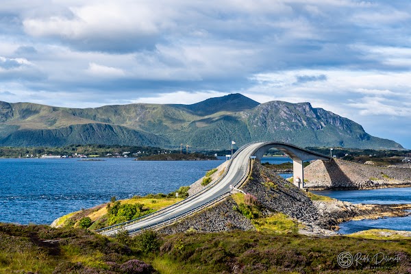
From October onward, low-pressure systems drive big swells straight onto the Hustadvika coast, and on the worst days the sea breaks clean across the exposed spans by Storseisundet Bridge. People come specifically for it, cameras ready at the official pull-offs.
Treat a storm day as a serious outing. The hazard is real. Waves can overtop the exposed sections, so park only in the signed areas, never stop on a bridge, and stay well back from the edge. Wind can make the high span of Storseisundet feel alarming in a tall or light vehicle. Check the 175 feed the morning you go, and if the forecast is extreme, watch from the mainland at Vevang rather than committing to the bridges.
What a well-timed drive looks like
Driven on a bright summer day, the Atlantic Ocean Road is a relaxed half to full day out from either end. It opens at Kårvåg, where Bjartmars Favorittkro serves local seafood near the start. Storseisundet Bridge comes early, the curving span that looks, from the right angle, like a ramp into the sky, with the Eldhusøya boardwalk looping out over the heather just beyond it for the best view back along the causeways.
From there the road threads Myrbærholmbrua, a double bridge with railed fishing walkways where locals drop a line, then runs on past Vevang to finish at Bud. The old fishing village holds the Ergan Coastal Fort, a wartime battery turned museum, and a harbourside kitchen for a late lunch before you turn back.
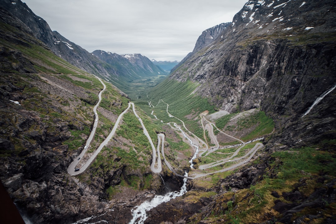
The whole thing is only 36 km, under an hour nonstop, so the stops, the walks, and the light are what make it a day rather than a transfer. If you are chaining Norwegian drives, the hairpins of Trollstigen sit a few hours south in the same county and pair naturally over a long weekend. Both belong to our wider collection of scenic coastal drives.
Frequently asked questions
What is the best month to drive the Atlantic Ocean Road?
August is the strongest single choice, with warm, long days, mostly calm seas, and every stop open, and the peak summer traffic starting to ease by the end of the month. June is a close second for daylight, and late September is the pick if you want autumn swells and empty viewpoints.
Is the Atlantic Ocean Road open in winter?
Yes. It is a coastal road, not a seasonal pass, so it stays open and ploughed through the winter. Severe storms can close it for a few hours while waves wash the carriageway, so confirm the same-day status on the 175 traffic service before you set out.
How long does it take to drive the Atlantic Ocean Road?
The route is 36 km and takes under an hour to drive nonstop. With the Eldhusøya boardwalk, the fishing bridge at Myrbærholmbrua, and the fort and lunch at Bud, most people make a comfortable half to full day of it.
Is the Atlantic Ocean Road safe in a storm?
It can be dangerous when a storm is running. Waves overtop the low sections, so stop only in the signed parking areas, never on a bridge, and keep well back from the water. Wind also buffets the high Storseisundet span, which is harder work in a tall or light vehicle.
Can you see the storm waves without driving the bridges?
Yes. The mainland shore at Vevang gives you a safe view of the swells breaking across the causeways, which is the sensible way to watch on the roughest days rather than parking out on the exposed spans.
Pick a calm summer morning for an easy run, or a stormy autumn afternoon for the drama, and the Atlantic Ocean Road rewards either plan if you time it to the sea. Read the full route guide for the Atlantic Ocean Road, then open the interactive map to build the Norwegian coast around it.