
الطريق السريع G219 شينجيانغ-التبت
الصين
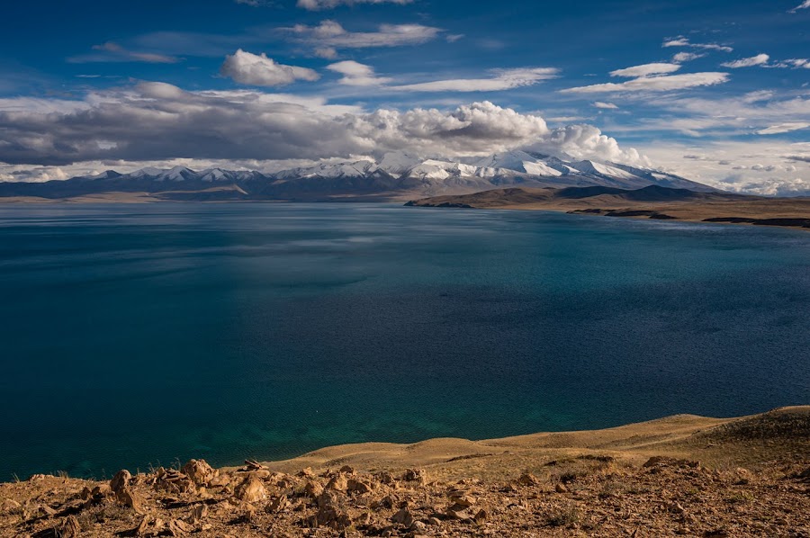
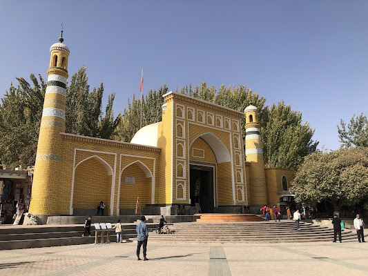
باختصار: الطريق السريع G219 شينجيانغ-التبت رحلة مغامرة بطول 4,000 km في الصين، تُقطع عادةً خلال 2-3 أسابيع وأفضل وقت لها يونيو-سبتمبر. أبرز المحطات: Kashgar، Hotan، Ngari Prefecture.
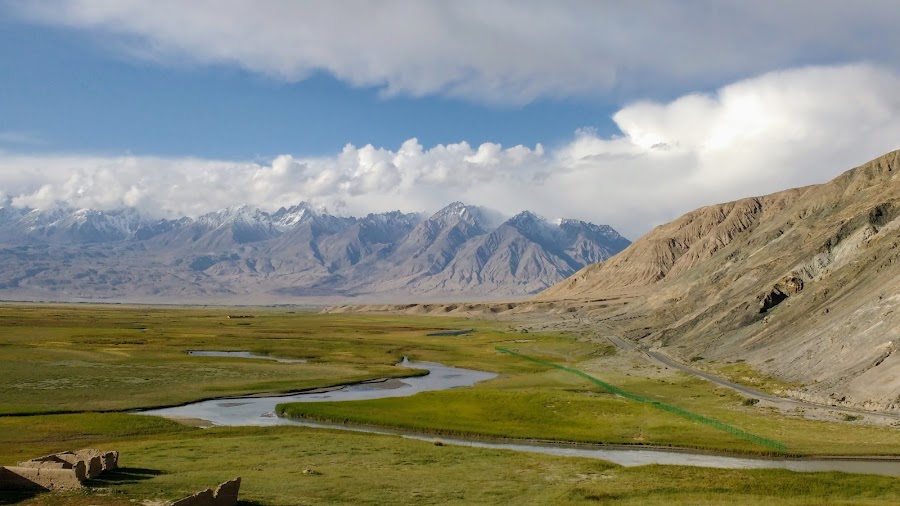
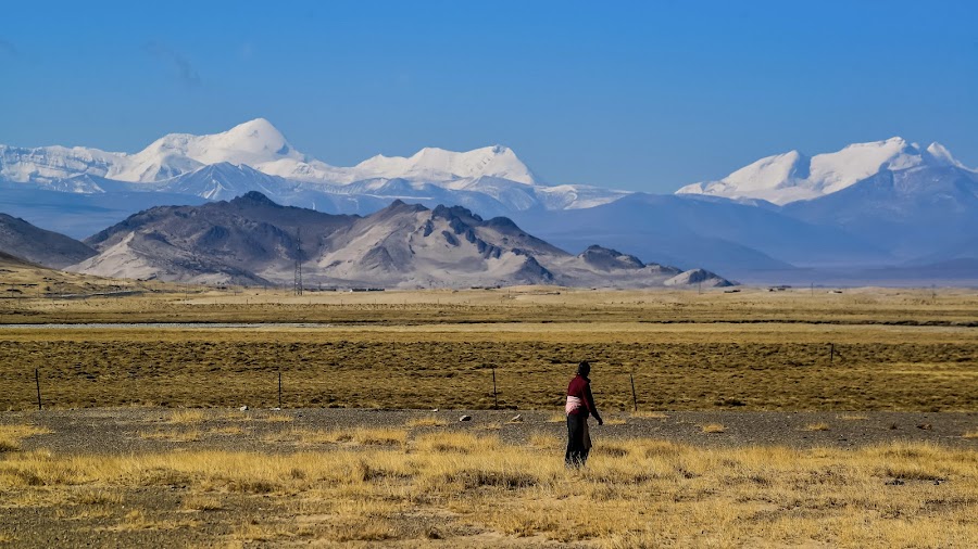
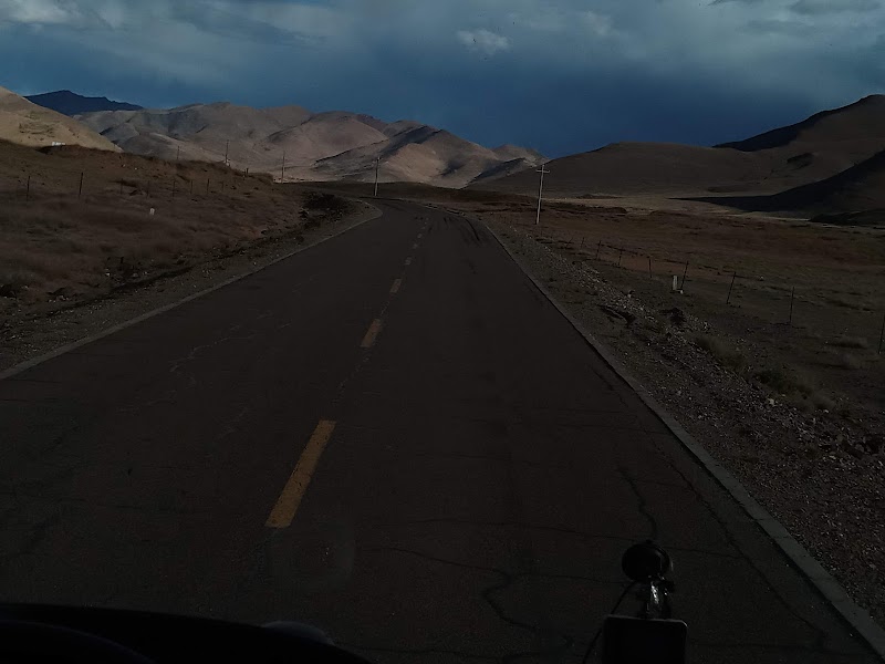
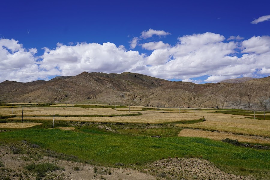
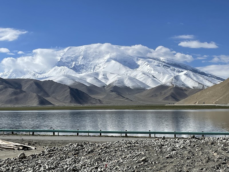
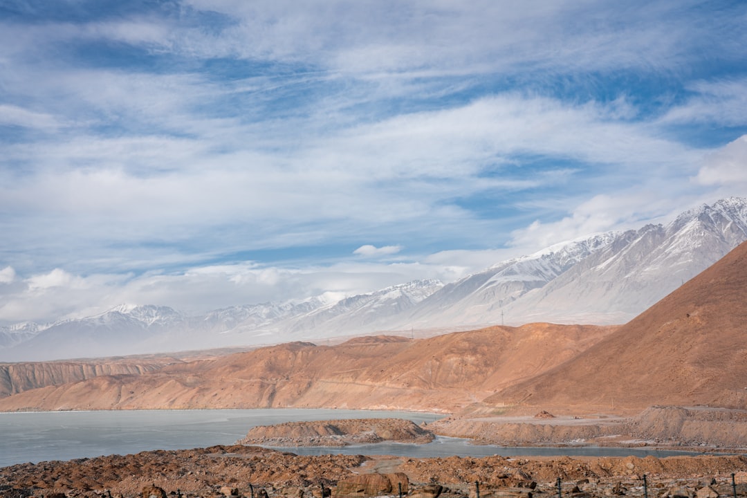
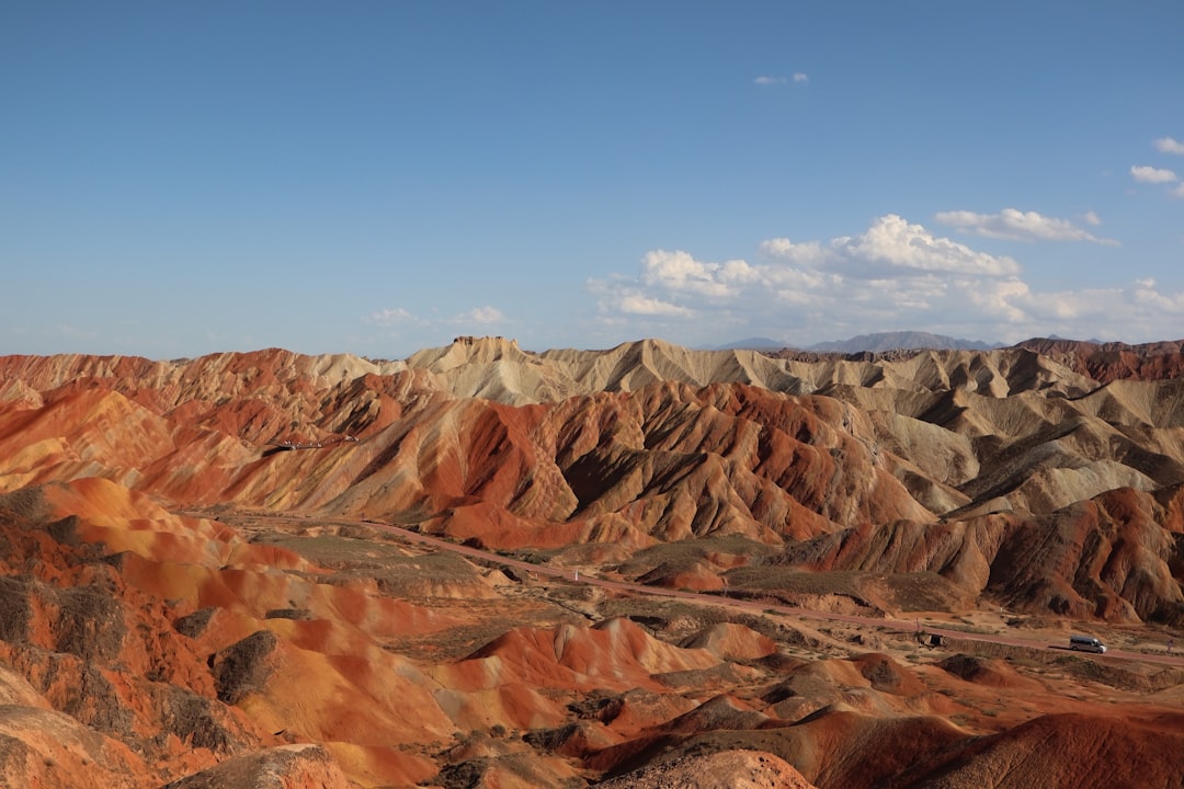
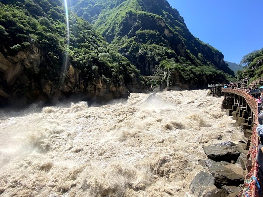
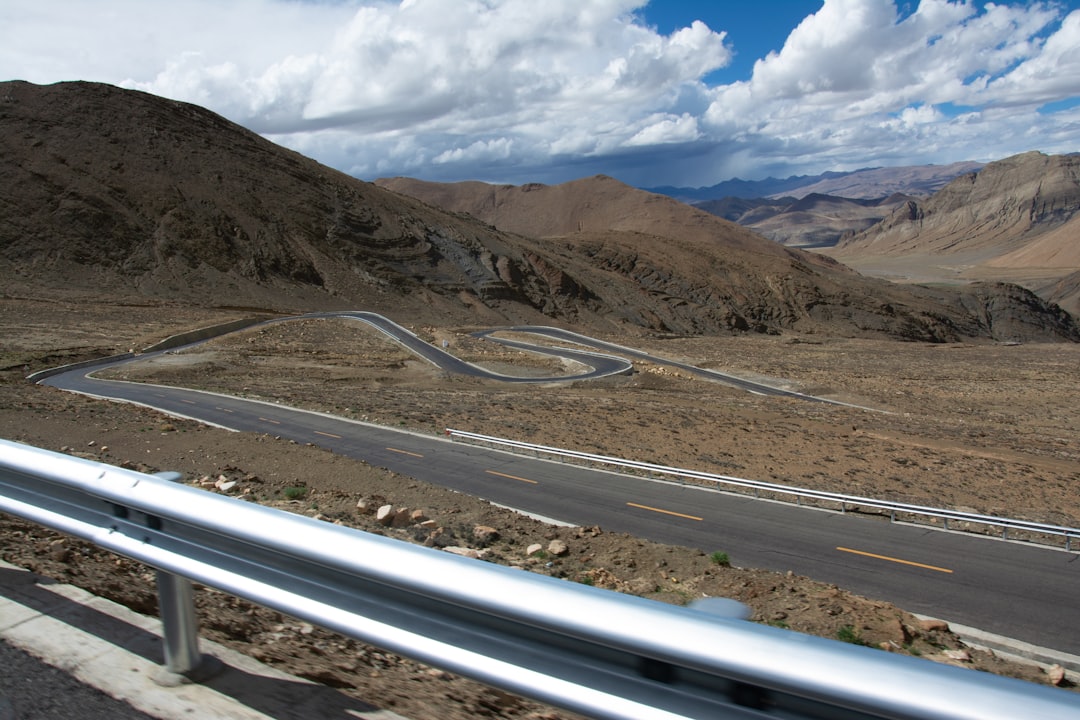
يمثل G219 في الصين رحلة واسعة عابرة لجبال الهيمالايا تربط شينجيانغ بغرب التبت عبر بعض أكثر المناطق عزلة في آسيا. توقّع ممرات عالية الارتفاع، وأحواض صحراوية قاسية، وبحيرات مالحة، وإطلالات على الأنهار الجليدية، ومقاطع طويلة من المستوطنات العسكرية والتعدينية، وكل ذلك يتطلب تخطيطاً دقيقاً والتأقلم مع الارتفاع.
Plan this trip
Third-party planning links may be affiliate links. RoadAtlas stays independent, and you should verify details with the provider.
محطات على الطريق
أشياء يمكن القيام بها


أماكن الأكل


طرق ذات صلة
طرق قريبة ومشابهة


الأسئلة الشائعة
كم يبلغ طول طريق الطريق السريع G219 شينجيانغ-التبت؟
يمتد طريق الطريق السريع G219 شينجيانغ-التبت لمسافة 4,000 km من البداية إلى النهاية.
كم تستغرق رحلة الطريق السريع G219 شينجيانغ-التبت؟
يقضي معظم المسافرين 2-3 أسابيع على طريق الطريق السريع G219 شينجيانغ-التبت، حسب التوقفات والإيقاع.
ما أفضل موسم لقيادة الطريق السريع G219 شينجيانغ-التبت؟
الموسم الموصى به لطريق الطريق السريع G219 شينجيانغ-التبت هو يونيو-سبتمبر.
من أين يبدأ الطريق السريع G219 شينجيانغ-التبت وأين ينتهي؟
يمتد طريق الطريق السريع G219 شينجيانغ-التبت من Kashgar إلى Lhatse County.
ما أبرز محطات طريق الطريق السريع G219 شينجيانغ-التبت؟
يمر طريق الطريق السريع G219 شينجيانغ-التبت عبر Kashgar، Hotan، Ngari Prefecture.
ما مدى صعوبة قيادة الطريق السريع G219 شينجيانغ-التبت؟
يُصنّف طريق الطريق السريع G219 شينجيانغ-التبت على أنه شديد الصعوبة، ويُفضّل قطعه باستخدام لـ 4wd فقط.
هل أحتاج إلى دفع رباعي لقيادة الطريق السريع G219 شينجيانغ-التبت؟
نعم — يحتوي الطريق السريع G219 شينجيانغ-التبت على مقاطع وعرة أو خارج الطريق تتطلب لـ 4wd فقط.
هل أحتاج تصريحًا أو إجراءات حدودية لـ الطريق السريع G219 شينجيانغ-التبت؟
نعم — يتطلب الطريق السريع G219 شينجيانغ-التبت تصاريح أو رسومًا أو إجراءات حدودية. خطط مسبقًا: هذا مسار حدودي عالي الارتفاع مع فجوات طويلة بين الخدمات والوقود والمساعدة الطارئة. تحقق من قواعد التصاريح الحالية، وإمكانية الوصول إلى المناطق الحدودية، وإغلاقات الطقس قبل الانطلاق؛ فقد تعطل الثلوج والانهيارات الأرضية ومرض المرتفعات الخطط بسرعة. احمل وقوداً إضافياً وماءً واتصالاً عبر الأقمار الصناعية إن أمكن.
كم محطة وقود يحتاجها طريق الطريق السريع G219 شينجيانغ-التبت؟
احسب نحو 7 محطة تعبئة (أو نحو 14 شحنة كهربائية) على طول الطريق السريع G219 شينجيانغ-التبت نظرًا لطوله البالغ 4,000 km.
هل قيادة الطريق السريع G219 شينجيانغ-التبت آمنة؟
هذا مسار حدودي عالي الارتفاع مع فجوات طويلة بين الخدمات والوقود والمساعدة الطارئة. تحقق من قواعد التصاريح الحالية، وإمكانية الوصول إلى المناطق الحدودية، وإغلاقات الطقس قبل الانطلاق؛ فقد تعطل الثلوج والانهيارات الأرضية ومرض المرتفعات الخطط بسرعة. احمل وقوداً إضافياً وماءً واتصالاً عبر الأقمار الصناعية إن أمكن.
ما المستوى المنظري لطريق الطريق السريع G219 شينجيانغ-التبت؟
الطريق السريع G219 شينجيانغ-التبت طريق أسطورية — أكثر طرق القيادة استثنائية في العالم — رحلات العمر بمناظر سينمائية وطرق أسطورية وعمق ثقافي لا يضاهى.