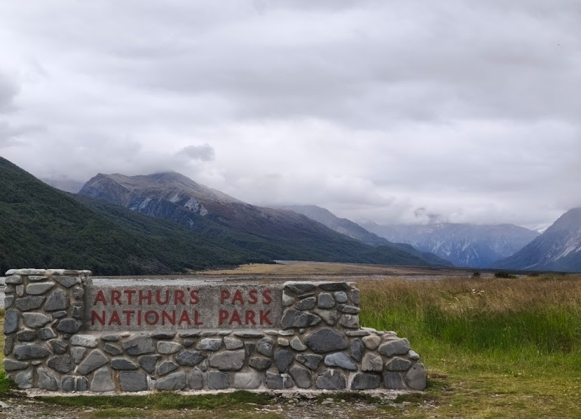
RoadAtlas
Arthur's Pass — نيوزيلندا — جبال
أستراليا والمحيط الهادئ

Arthur's Pass

نيوزيلندا

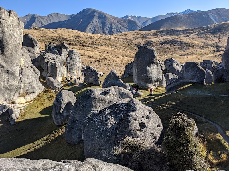
باختصار: Arthur's Pass رحلة جبال بطول 240 km في نيوزيلندا، تُقطع عادةً خلال 1-2 أيام وأفضل وقت لها ديسمبر إلى أبريل. أبرز المحطات: Christchurch، Castle Hill Basin، Kura Tawhiti Conservation Area.

المسافة
240 km
المدة
1-2 أيام
أفضل موسم
ديسمبر إلى أبريل
أيقونيةمتوسطجبال

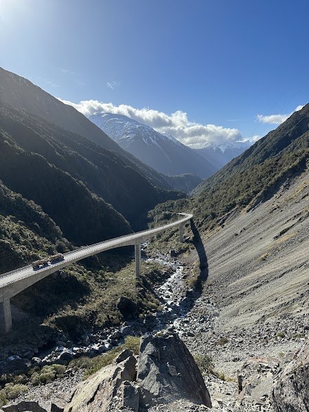
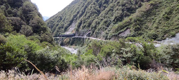
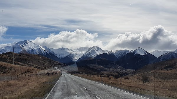
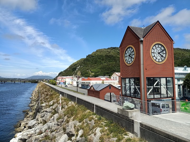
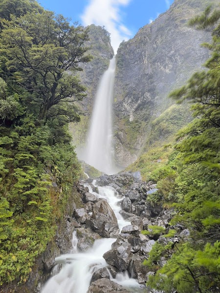
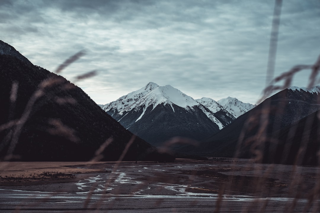
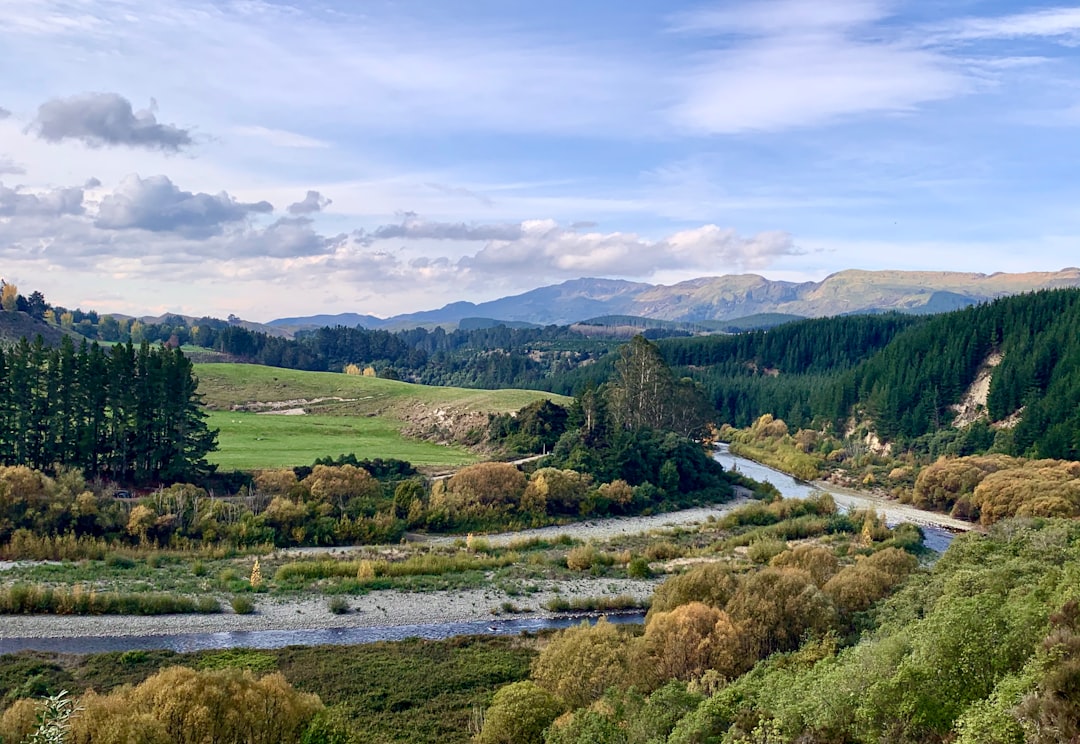
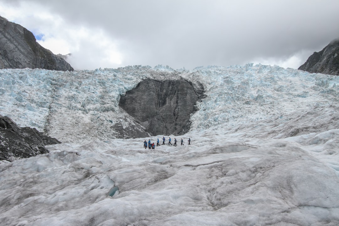
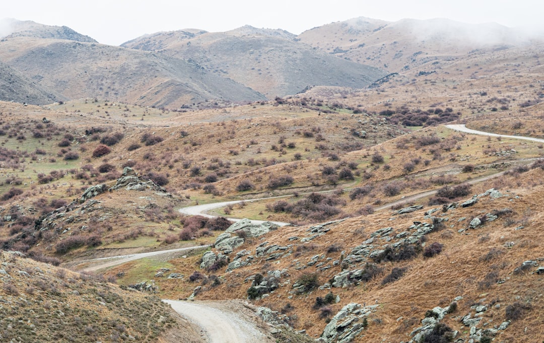
ينطلق هذا المسار الكلاسيكي في الجزيرة الجنوبية من Christchurch عبر Canterbury Plains إلى قرية Arthur’s Pass الألبية ثم إلى الساحل الغربي. يجمع بين الأنهار المتشعبة، وغابات الزان، وجدران الجبال الشديدة، والهندسة المذهلة للجسور العالية، مع وصول سهل من الطريق إلى مشي قصير ونقاط إطلالة.

ملاحظات عملية
يأتي الشتاء بالثلج والجليد الأسود وإغلاقات عرضية للطريق فوق الممر، لذا تحقّق من ظروف الطرق لدى NZTA قبل المغادرة. الوقود والخدمات محدودان بعد مغادرة Canterbury، ويمكن للطقس أن يتغير بسرعة في Southern Alps.
استكشف على الخريطة التفاعلية ←

Plan this trip

Third-party planning links may be affiliate links. RoadAtlas stays independent, and you should verify details with the provider.

محطات على الطريق

Christchurch — المغادرة — Arthur's Pass — نيوزيلندا
المغادرة
Christchurch
غادر Garden City واتجه غربًا عبر Canterbury Plains. يهيئ الوصول السهل إلى الطريق وأراضٍ زراعية منبسطة التحول الألبي القادم.
فنادق
Arthur's Pass Village — مدينة — Arthur's Pass — نيوزيلندا
مدينة
Arthur's Pass Village
قرية ألبية صغيرة محاطة بقمم حادة وغابة زان. إنها أفضل قاعدة للمشي القصير والقهوة وإطلالات الجبال.
فنادق
Jacksons — مدينة — Arthur's Pass — نيوزيلندا
مدينة
Jacksons
تجمع هادئ على الساحل الغربي تبدأ فيه الجبال بالتحول إلى غابة مطيرة. إنه نقطة انتقال مفيدة قبل الانطلاقة الأخيرة غربًا.
فنادق
Greymouth — الوصول — Arthur's Pass — نيوزيلندا
الوصول
Greymouth
أنهِ على الساحل الغربي الوعر في أكبر بلدة على الساحل الغربي للجزيرة الجنوبية في نيوزيلندا. بعد الممر، يحل هواء البحر والغابة المطيرة محل قمم الجبال الألبية.
فنادق

أشياء يمكن القيام بها
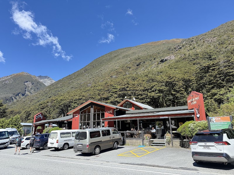
Castle Hill Basin — معلم — Arthur's Pass — نيوزيلندا
معلم
Castle Hill Basin
حوض واسع مرقّط بصخور جيرية باهتة وإطلالات على سماء مفتوحة. يبدو المشهد قاسيًا ومشكّلًا قبل الصعود إلى التلال.
Kura Tawhiti Conservation Area — طبيعة — Arthur's Pass — نيوزيلندا
طبيعة
Kura Tawhiti Conservation Area
امشِ بين تكوينات صخرية ضخمة متآكلة ومسارات قصيرة بين نبات tussock. إنه أحد أكثر المناظر الجانبية إثارة على طول الطريق.
Devils Punchbowl Waterfall — طبيعة — Arthur's Pass — نيوزيلندا
طبيعة
Devils Punchbowl Waterfall
يقود صعود قصير إلى شلال قوي يهبط عبر الغابة المحلية. الرذاذ، وغناء الطيور، وجسر معلق تجعل التجربة لا تُنسى.
Otira Viaduct Lookout — معلم — Arthur's Pass — نيوزيلندا
معلم
Otira Viaduct Lookout
توقف فوق الجسر الشهير وهو يتلوى عبر وادٍ شديد الانحدار. تجعل الهندسة والخلفية الجبلية هذا التوقف صورة كلاسيكية في الجزيرة الجنوبية.
Kura Tawhiti / Castle Hill Rocks Walk — Nature walk — Arthur's Pass — نيوزيلندا
Nature walk
Kura Tawhiti / Castle Hill Rocks Walk
Explore giant limestone boulders and short walking tracks in the conservation area. The landscape is easy to reach and visually dramatic.
Devils Punchbowl Walking Track — Waterfall walk — Arthur's Pass — نيوزيلندا
Waterfall walk
Devils Punchbowl Walking Track
Take the short, steep trail to a major waterfall in Arthur's Pass National Park. It is one of the route’s best quick hikes.
Arthur's Pass Visitor Centre — Visitor centre — Arthur's Pass — نيوزيلندا
Visitor centre
Arthur's Pass Visitor Centre
Learn about local tracks, weather, and wildlife before heading out. It is useful for planning safer alpine stops.
Otira Viaduct Lookout — Scenic viewpoint — Arthur's Pass — نيوزيلندا
Scenic viewpoint
Otira Viaduct Lookout
Stop for a clear view of the sweeping viaduct and Otira Gorge. The lookout is one of the route’s signature photo spots.
TranzAlpine Scenic Rail Experience — Scenic travel — Arthur's Pass — نيوزيلندا
Scenic travel
TranzAlpine Scenic Rail Experience
See the same mountain corridor by train between Christchurch and the West Coast. It is one of New Zealand’s classic rail journeys.

أماكن الأكل

The Bealey Hotel — Pub food — Arthur's Pass — نيوزيلندا
Pub food
The Bealey Hotel
A classic roadside stop near Arthur's Pass for hearty meals and drinks. It is a practical place to refuel in the mountains.
Arthur's Pass Cafe and Store — Cafe — Arthur's Pass — نيوزيلندا
Cafe
Arthur's Pass Cafe and Store
Simple lunches, coffee, and snacks right in the village. Handy for an easy stop before or after a short walk.
Sheffield Pie Shop — Bakery — Arthur's Pass — نيوزيلندا
Bakery
Sheffield Pie Shop
A popular Canterbury stop for pies and takeaway food. It works well as an early road-trip breakfast or lunch pickup.
Monteith's Brewery Bar — Pub food — Arthur's Pass — نيوزيلندا
Pub food
Monteith's Brewery Bar
A familiar West Coast stop in Greymouth for local brews and relaxed meals. It is a good finish-line lunch or dinner spot.
Ali's Eating and Drinking — Cafe — Arthur's Pass — نيوزيلندا
Cafe
Ali's Eating and Drinking
Casual food and coffee in Greymouth with easy parking nearby. Good for a final stop after crossing the pass.

طرق ذات صلة

طرق قريبة ومشابهة

الأسئلة الشائعة

كم يبلغ طول طريق Arthur's Pass؟

يمتد طريق Arthur's Pass لمسافة 240 km من البداية إلى النهاية.

كم تستغرق رحلة Arthur's Pass؟

يقضي معظم المسافرين 1-2 أيام على طريق Arthur's Pass، حسب التوقفات والإيقاع.

ما أفضل موسم لقيادة Arthur's Pass؟

الموسم الموصى به لطريق Arthur's Pass هو ديسمبر إلى أبريل.

من أين يبدأ Arthur's Pass وأين ينتهي؟

يمتد طريق Arthur's Pass من Christchurch إلى Greymouth.

ما أبرز محطات طريق Arthur's Pass؟

يمر طريق Arthur's Pass عبر Christchurch، Castle Hill Basin، Kura Tawhiti Conservation Area.

هل يمكن قيادة Arthur's Pass بسيارة عادية؟

نعم — طريق Arthur's Pass مُعبَّد بالكامل، والسيارة العادية كافية في الظروف العادية.

هل قيادة Arthur's Pass آمنة؟

يأتي الشتاء بالثلج والجليد الأسود وإغلاقات عرضية للطريق فوق الممر، لذا تحقّق من ظروف الطرق لدى NZTA قبل المغادرة. الوقود والخدمات محدودان بعد مغادرة Canterbury، ويمكن للطقس أن يتغير بسرعة في Southern Alps.

ما المستوى المنظري لطريق Arthur's Pass؟

Arthur's Pass طريق أيقونية — رحلات أيقونية تُرسّخ سمعة المنطقة — مناظر تشبه البطاقات البريدية، طرق مميزة، ومسارات يحلم بقيادتها معظم المسافرين.