North Yungas Road Guided Cycling Day
Bolivia
In short: North Yungas Road Guided Cycling Day is a about 60 km plus operator transfers adventure road trip in Bolivia, typically driven over 1 day, best in May-October. Highlights: La Paz, Unduavi, Chuspipata.
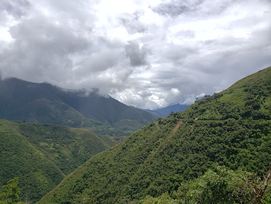
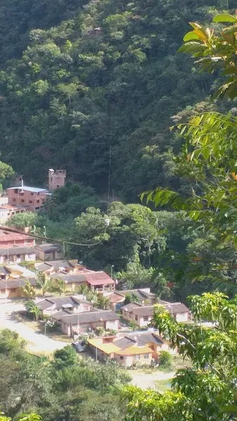
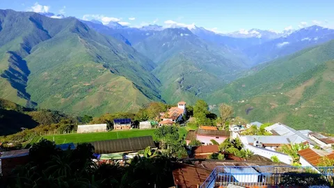
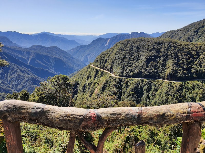
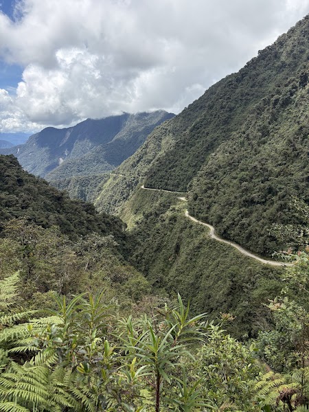
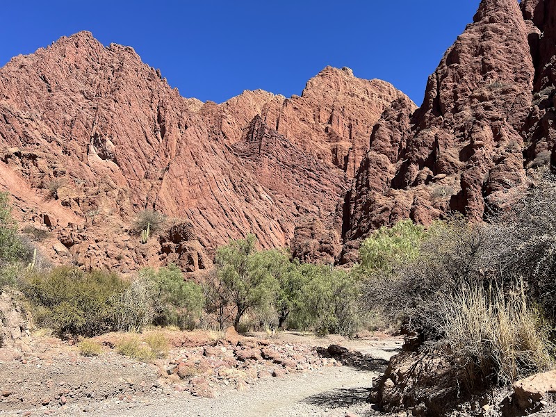
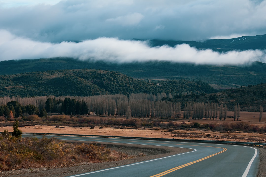
Bolivia’s North Yungas Road drops from the high Andes near La Paz into the humid Yungas valleys on a dramatic, tightly winding descent. Expect cliffside curves, changing weather, and sweeping mountain-to-jungle scenery on a historic route once notorious for its extreme exposure.
Make this route yours
Set your dates, pace, and taste, and RoadAtlas AI rebuilds this trip day by day with real, verified places.
Included with Traveler and Explorer plans.
Plan this trip
Third-party planning links may be affiliate links. RoadAtlas stays independent, and you should verify details with the provider.
Day-by-day itinerary
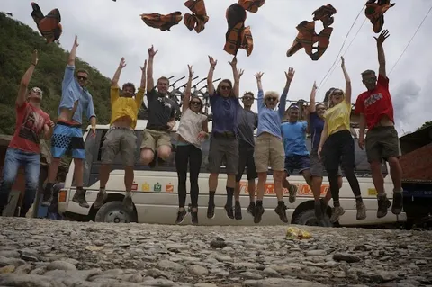
Day 1Prebooked La Paz–La Cumbre–Yolosa guided cycling day
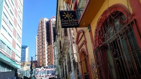
La Cumbre Pass · Death Road Downhill Bike Tour · Cafe del Sol
Stops along the route
Things to Do
Where to Eat
Nearby and similar drives
Frequently asked questions
How long is the North Yungas Road Guided Cycling Day drive?
The North Yungas Road Guided Cycling Day covers about 60 km plus operator transfers from start to finish.
How long does the North Yungas Road Guided Cycling Day take to drive?
Most travellers spend 1 day on the North Yungas Road Guided Cycling Day, depending on stops and pace.
When is the best time to drive the North Yungas Road Guided Cycling Day?
The recommended season for the North Yungas Road Guided Cycling Day is May-October.
Where does the North Yungas Road Guided Cycling Day start and end?
The North Yungas Road Guided Cycling Day runs from La Paz to Coroico.
What are the main stops on the North Yungas Road Guided Cycling Day?
The North Yungas Road Guided Cycling Day passes through La Paz, Unduavi, Chuspipata.
How difficult is the North Yungas Road Guided Cycling Day to drive?
The North Yungas Road Guided Cycling Day is rated extreme and is best handled with suv only.
Do I need a 4WD for the North Yungas Road Guided Cycling Day?
Yes — the North Yungas Road Guided Cycling Day includes off-road or rough sections that require suv only.
Do I need a permit or border paperwork for the North Yungas Road Guided Cycling Day?
Yes — the North Yungas Road Guided Cycling Day requires permits, fees, or border paperwork. Plan ahead: Book a reputable insured cycling operator with hotel transfers, inspected bike/brakes/helmet/protective gear, guide first-aid kit and support vehicle. Confirm the ABC road/blockade map, weather and operator go/no-go that morning; never cross blockades and cancel for heavy rain or fog. Screen for La Cumbre altitude and require insurance explicitly covering downhill mountain biking and evacuation. Support/return travel uses the modern highway; this is not a self-drive sightseeing loop.
Is the North Yungas Road Guided Cycling Day safe to drive?
Book a reputable insured cycling operator with hotel transfers, inspected bike/brakes/helmet/protective gear, guide first-aid kit and support vehicle. Confirm the ABC road/blockade map, weather and operator go/no-go that morning; never cross blockades and cancel for heavy rain or fog. Screen for La Cumbre altitude and require insurance explicitly covering downhill mountain biking and evacuation. Support/return travel uses the modern highway; this is not a self-drive sightseeing loop.
What scenic tier is the North Yungas Road Guided Cycling Day?
The North Yungas Road Guided Cycling Day is a legendary drive — The world's most extraordinary drives — once-in-a-lifetime road trips with cinematic scenery, legendary roads, and unmatched cultural depth.