Eastern Anatolia to Trabzon
Türkiye
In short: Eastern Anatolia to Trabzon is a about 1,700 km scenic road trip in Türkiye, typically driven over 9 days, best in May–Oct. Highlights: Diyarbakır, Mount Nemrut, Tatvan.
A complete nine-day east-Türkiye traverse: Diyarbakır, Nemrut, a Tatvan transit night, Akdamar and Van, Doğubayazıt, Kars and Ani, Erzurum, then Trabzon and Sumela. The missing Black Sea finish and unrealistic Van transfer are corrected.
Make this route yours
Set your dates, pace, and taste, and RoadAtlas AI rebuilds this trip day by day with real, verified places.
Included with Traveler and Explorer plans.
Plan this trip
Third-party planning links may be affiliate links. RoadAtlas stays independent, and you should verify details with the provider.
Day-by-day itinerary
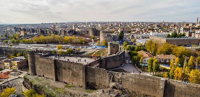
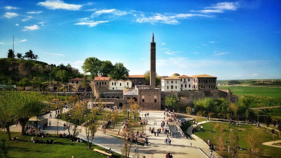
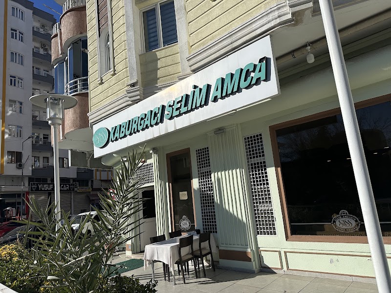
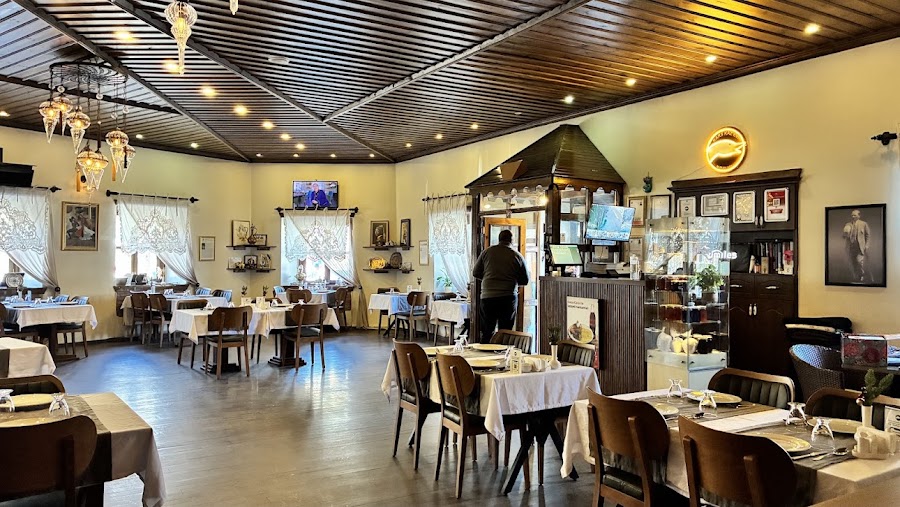
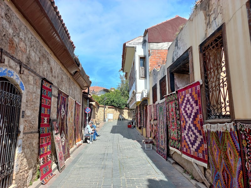
Day 1Diyarbakır
Diyarbakır walls · Sur historic quarter · Kaburgacı Selim Amca – Diyarbakır
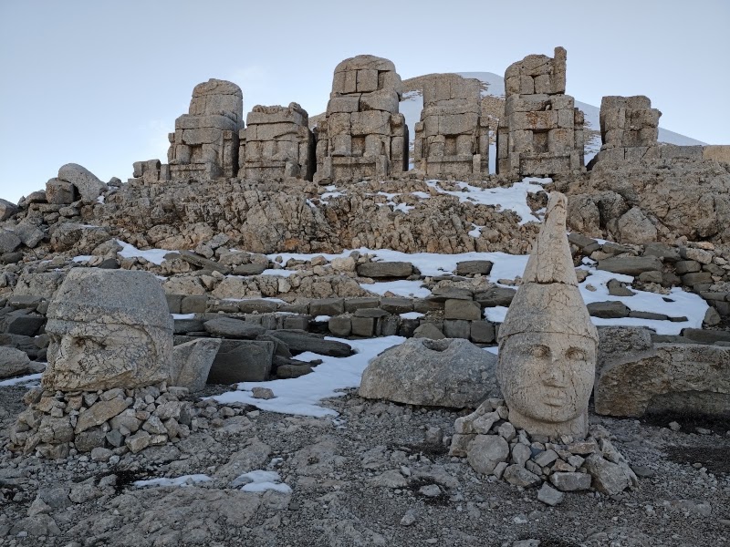
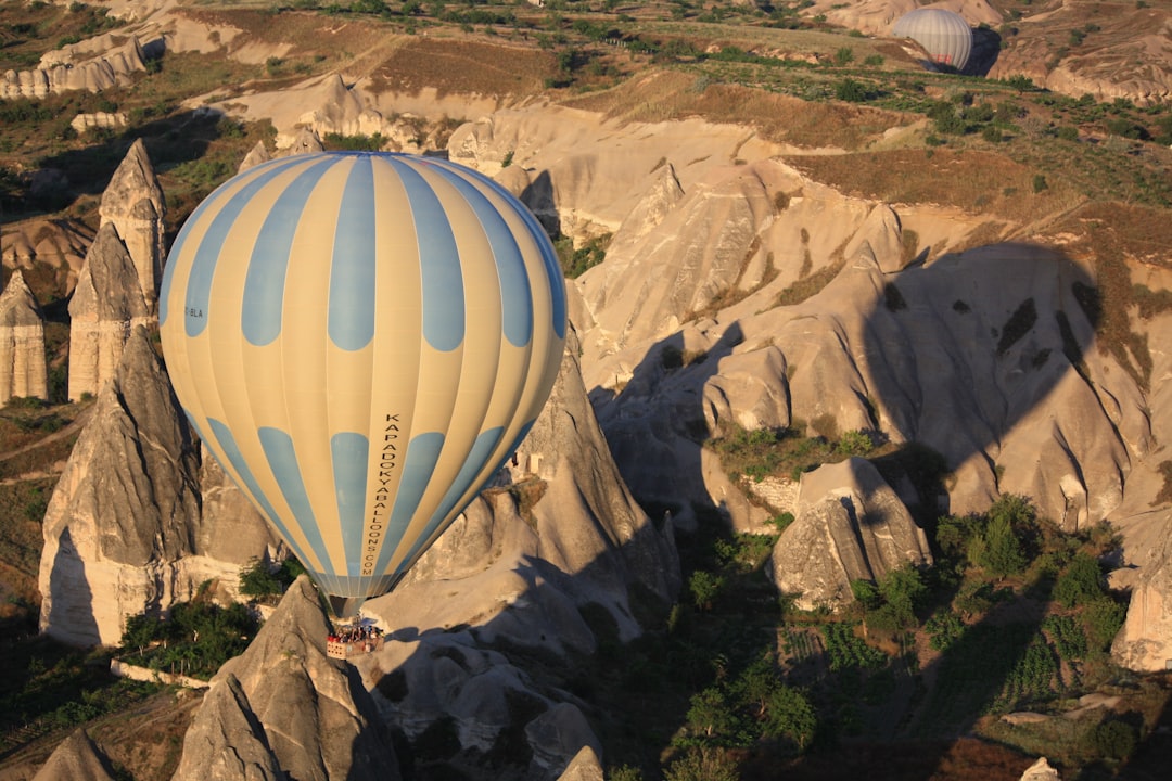
Day 2Diyarbakır → Mount Nemrut/Kahta → Adıyaman (about 300 km; 5 hr plus visit)
Transfer to Kahta · Mount Nemrut · Asmaaltı – Adıyaman
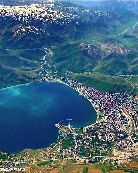
Day 3Adıyaman → Tatvan (about 470 km; 6–7 hr)
Long eastbound transfer · Tatvan lakeside walk · HapiFood – Tatvan
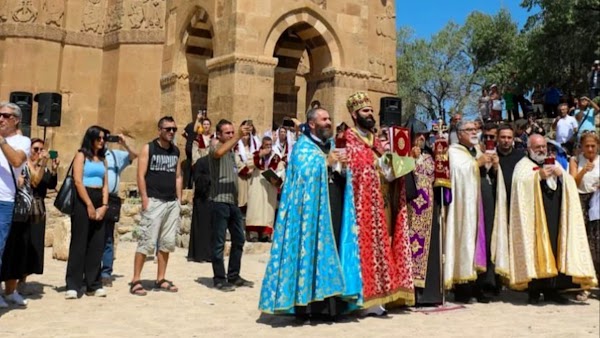
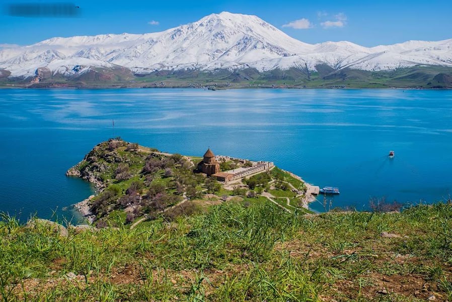
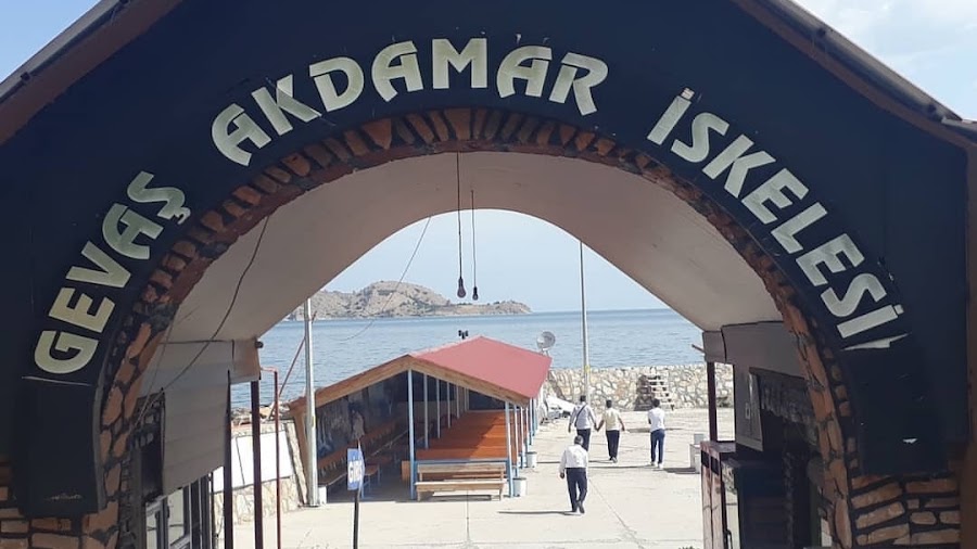
Day 4Tatvan → Akdamar Island → Van (about 170 km plus ferry)
Akdamar ferry and church · Van Castle sunset · Aşiyan Ev Yemekleri – Van
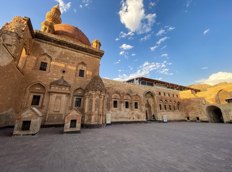
Day 5Van → Doğubayazıt (about 180 km; 2.5–3 hr)
Lake Van to Doğubayazıt transfer · İshak Paşa Palace · Doğuş Hotel Restaurant – Doğubayazıt
Day 6Doğubayazıt → Kars (about 220 km; 3–4 hr)
Northbound mountain transfer · Kars old quarter · Kars Kaz Evi – Kars
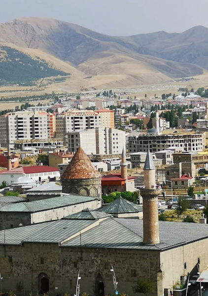
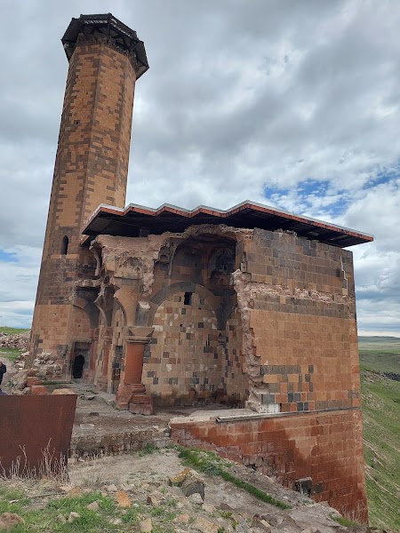
Day 7Kars → Ani → Erzurum (about 300 km; 4–5 hr plus visit)
Ani archaeological site · Transfer to Erzurum · Aksu Cağ Kebap – Erzurum
Day 8Erzurum → Trabzon (about 260 km; 4–5 hr mountain drive)
Erzurum heritage morning · Pontic mountain crossing · Akçatepe – Akçaabat
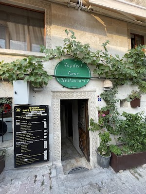
Day 9Trabzon → Sumela Monastery → Trabzon (about 95 km)
Sumela Monastery · Trabzon finish · Pesent – Akçaabat
Stops along the route

Things to Do
Show 4 more
Where to Eat


Show 2 more


Nearby and similar drives


Frequently asked questions
How long is the Eastern Anatolia to Trabzon drive?
The Eastern Anatolia to Trabzon covers about 1,700 km from start to finish.
How long does the Eastern Anatolia to Trabzon take to drive?
Most travellers spend 9 days on the Eastern Anatolia to Trabzon, depending on stops and pace.
When is the best time to drive the Eastern Anatolia to Trabzon?
The recommended season for the Eastern Anatolia to Trabzon is May–Oct.
Where does the Eastern Anatolia to Trabzon start and end?
The Eastern Anatolia to Trabzon runs from Diyarbakır to Trabzon and Sumela.
What are the main stops on the Eastern Anatolia to Trabzon?
The Eastern Anatolia to Trabzon passes through Diyarbakır, Mount Nemrut, Tatvan.
How difficult is the Eastern Anatolia to Trabzon to drive?
The Eastern Anatolia to Trabzon is rated moderate and is best handled with any vehicle.
Can I drive the Eastern Anatolia to Trabzon in a regular car?
Yes — the Eastern Anatolia to Trabzon is paved end-to-end and a regular car is fine in normal conditions.
How many fuel stops are needed on the Eastern Anatolia to Trabzon?
Plan around 3 refuels (or about 6 EV charges) along the Eastern Anatolia to Trabzon, based on its about 1,700 km length.
Is the Eastern Anatolia to Trabzon safe to drive?
As of July 13, 2026, the U.S. State Department rates Türkiye Level 2 (advisory issued June 9, 2026) and says do not travel within 10 km of the Syria and Iraq borders. This itinerary does not require those border strips, but eastern security controls and road closures can change. Check official advice, weather and mountain-road status daily; avoid night driving, keep identification available and do not improvise border-area detours.
What scenic tier is the Eastern Anatolia to Trabzon?
The Eastern Anatolia to Trabzon is a iconic drive — Iconic road trips that anchor a region's reputation — postcard scenery, headline highways, and the routes most travellers want to drive.