Nördlicher und westlicher Wild Atlantic Way bis zum Ring of Kerry
Irland
Kurz gesagt: Nördlicher und westlicher Wild Atlantic Way bis zum Ring of Kerry ist ein landschaftlich schön Roadtrip von Etwa 1.450 km in Irland, üblich in 10 Tage gefahren, ideal von Mai–Sep. Highlights: Malin Head, Slieve League, Sligo.
Eine lineare zehntägige Reise von Malin Head durch Donegal, Sligo, Achill, Connemara, Galway, Clare, Dingle, Killarney und den Ring of Kerry.
Machen Sie diese Route zu Ihrer
Wählen Sie Termine, Tempo und Vorlieben, und die RoadAtlas-KI baut diese Reise Tag für Tag mit echten, geprüften Orten neu auf.
Enthalten in den Traveler- und Explorer-Tarifen.
Diese Reise planen
Planungslinks von Drittanbietern können Affiliate-Links sein. RoadAtlas bleibt unabhängig; überprüfe die Details beim Anbieter.
Reiseplan nach Tagen
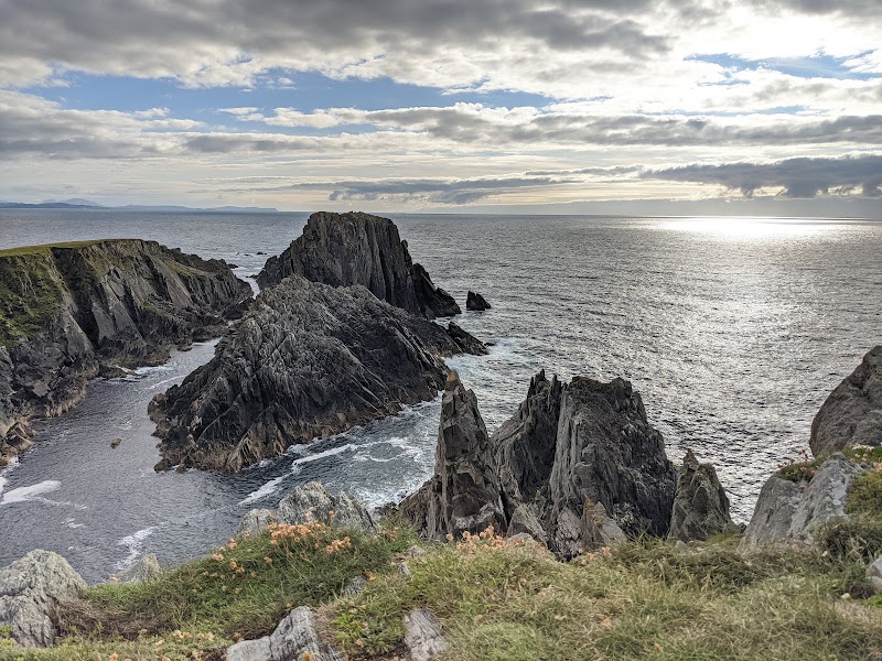
Tag 1Malin Head und Inishowen
Banba’s Crown und Malin Head · Nancy's Barn
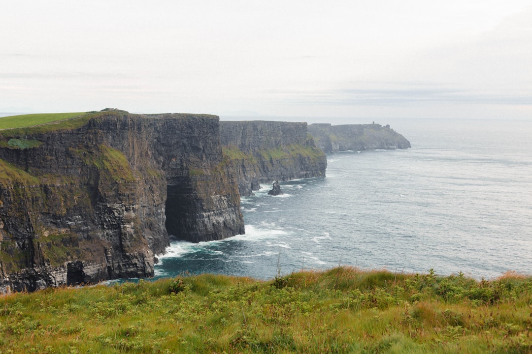
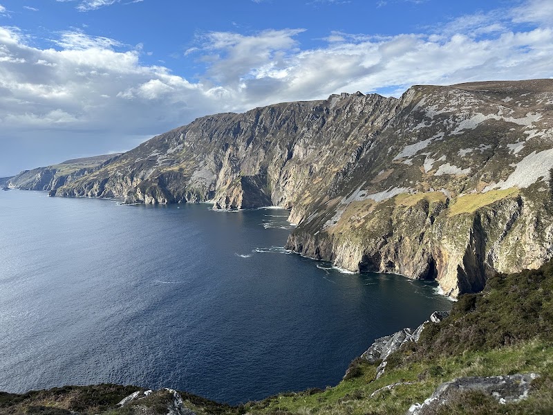
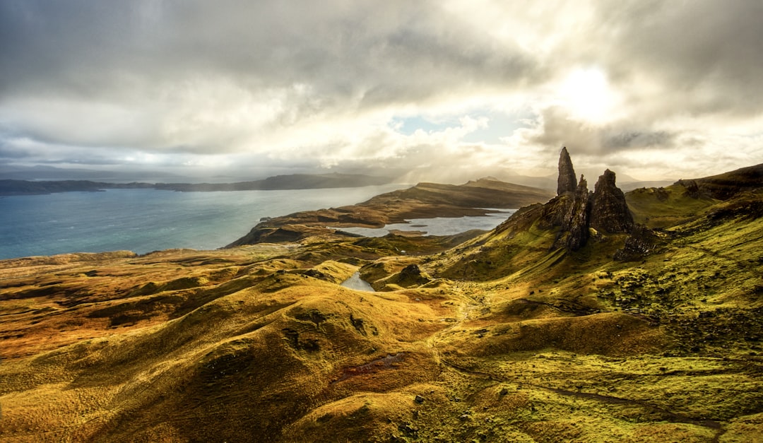
Tag 2Malin/Donegal nach Slieve League
Hauptaussichtsplattformen von Slieve League · The Rusty Mackerel
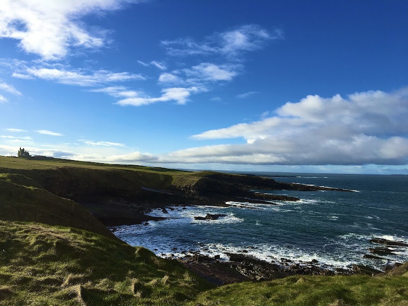
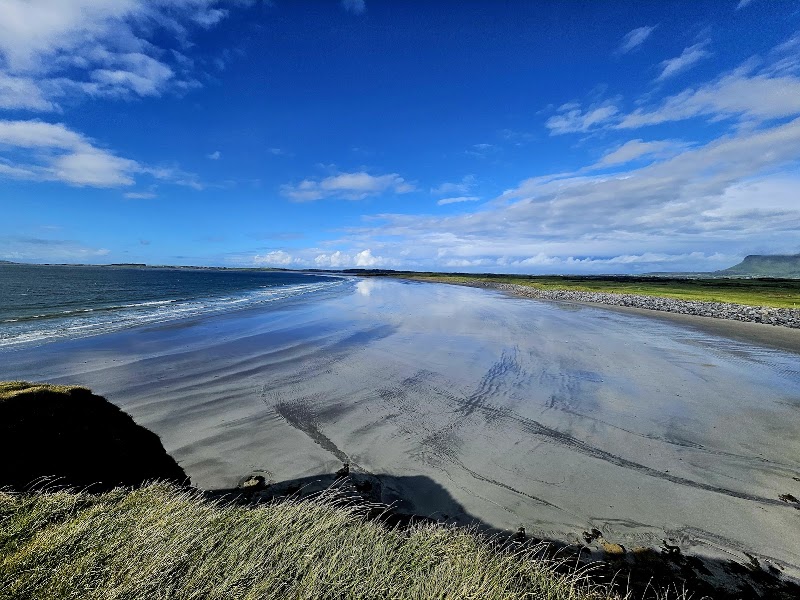
Tag 3Donegal nach Sligo
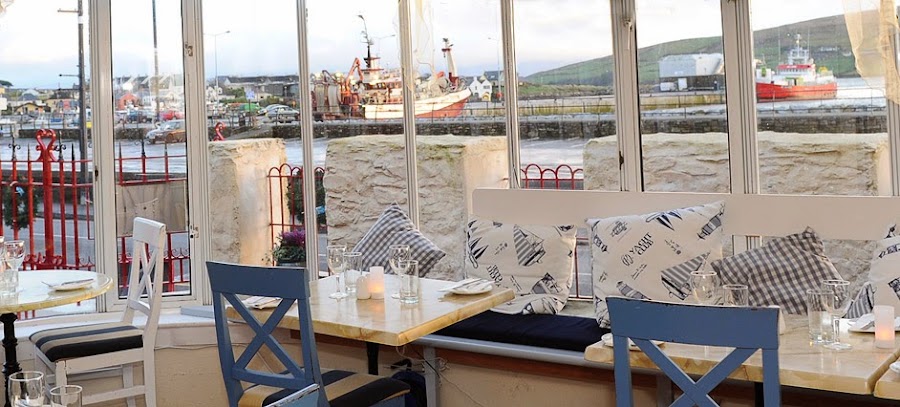
Küste von Sligo und Yeats-Land · Eala Bhán
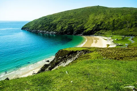
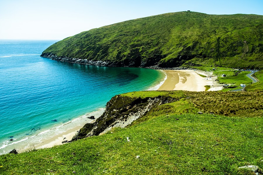
Tag 4Sligo nach Achill Island
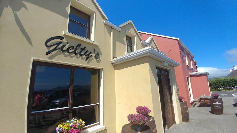
Keem Bay und Aussichtspunkte auf Achill · Gielty's Clew Bay Bar & Restaurant
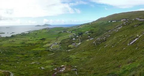
Tag 5Achill über Westport nach Clifden / Connemara
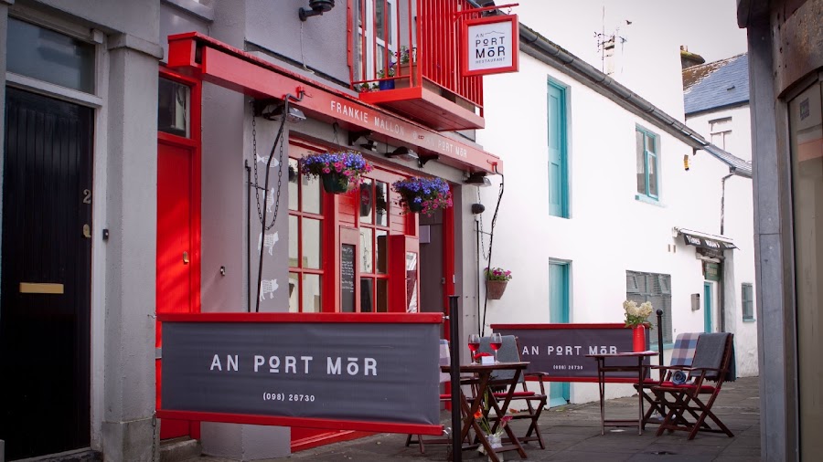
Westport und Transfer durch Connemara · An Port Mór
Tag 6Clifden über Galway und den Burren nach Doolin
Altstadt von Galway und Burren-Landschaft · Vaughan's Anchor Inn
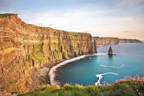
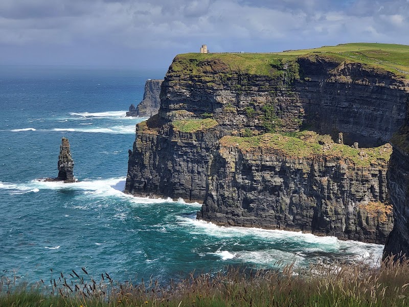
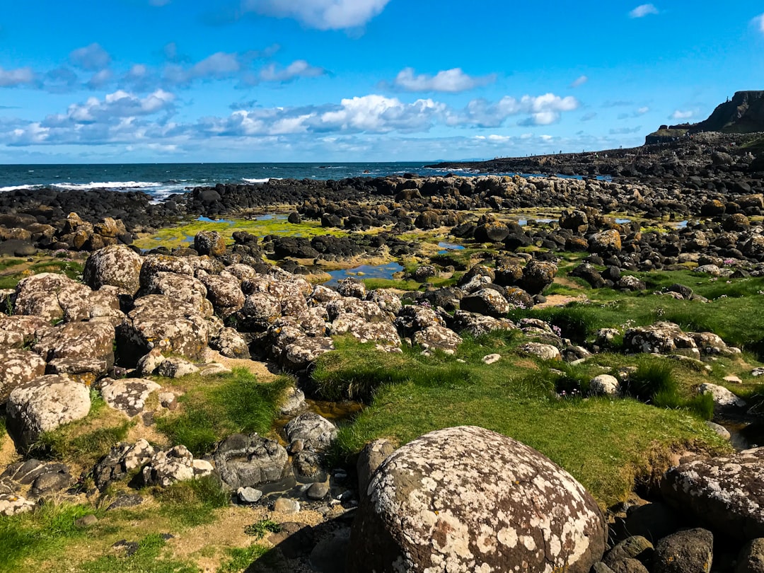
Tag 7Cliffs of Moher nach Dingle
Offizielles Besuchserlebnis an den Cliffs of Moher · The Boatyard
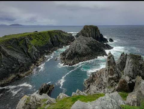
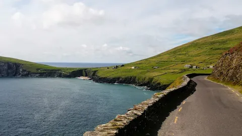
Tag 8Slea Head Drive im Uhrzeigersinn
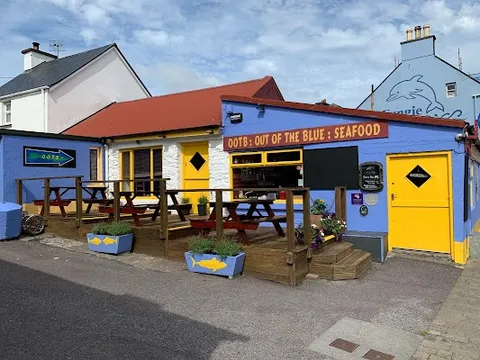
Slea Head und Dunquin · Out of the Blue
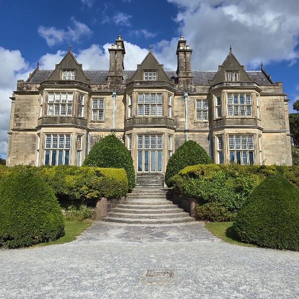
Tag 9Dingle zum Killarney National Park
Killarney National Park und Muckross · The Mad Monk by Quinlans
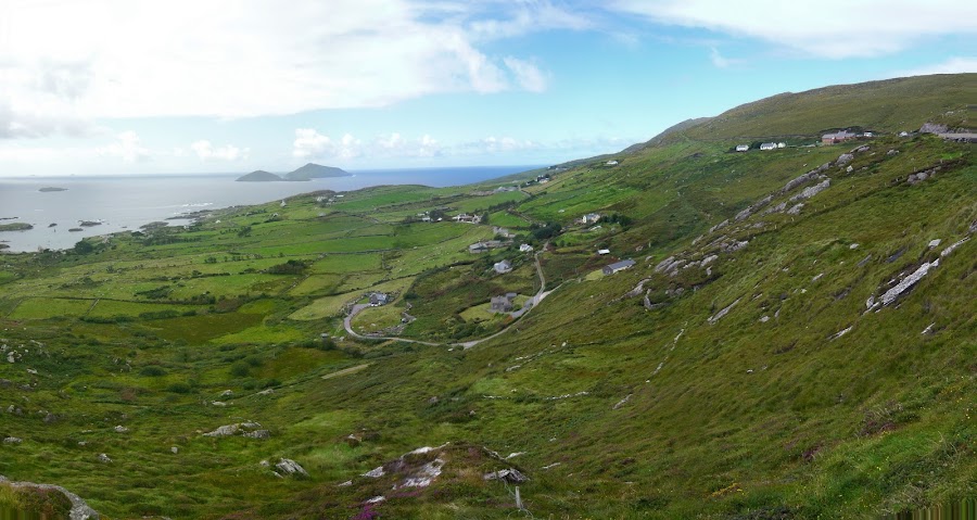
Tag 10Ring of Kerry im Uhrzeigersinn
Ring of Kerry und Skellig Ring · The Moorings
Stationen der Route

Sehenswürdigkeiten & Aktivitäten

Weitere 9 anzeigen


Wo man essen kann


Weitere 4 anzeigen

Routen in der Nähe
Häufige Fragen
Wie lang ist die Nördlicher und westlicher Wild Atlantic Way bis zum Ring of Kerry?
Die Nördlicher und westlicher Wild Atlantic Way bis zum Ring of Kerry ist Etwa 1.450 km lang.
Wie lange dauert die Nördlicher und westlicher Wild Atlantic Way bis zum Ring of Kerry?
Die meisten Reisenden brauchen 10 Tage für die Nördlicher und westlicher Wild Atlantic Way bis zum Ring of Kerry, abhängig von Stopps und Tempo.
Wann ist die beste Zeit für die Nördlicher und westlicher Wild Atlantic Way bis zum Ring of Kerry?
Die empfohlene Reisezeit für die Nördlicher und westlicher Wild Atlantic Way bis zum Ring of Kerry ist Mai–Sep.
Wo beginnt und endet die Nördlicher und westlicher Wild Atlantic Way bis zum Ring of Kerry?
Die Nördlicher und westlicher Wild Atlantic Way bis zum Ring of Kerry führt von Malin Head nach Ring of Kerry.
Was sind die wichtigsten Stationen auf der Nördlicher und westlicher Wild Atlantic Way bis zum Ring of Kerry?
Die Nördlicher und westlicher Wild Atlantic Way bis zum Ring of Kerry führt durch Malin Head, Slieve League, Sligo.
Wie schwierig ist die Nördlicher und westlicher Wild Atlantic Way bis zum Ring of Kerry zu fahren?
Die Nördlicher und westlicher Wild Atlantic Way bis zum Ring of Kerry gilt als einfach und wird am besten mit jedes fahrzeug befahren.
Kann man die Nördlicher und westlicher Wild Atlantic Way bis zum Ring of Kerry mit einem normalen Auto fahren?
Ja — die Nördlicher und westlicher Wild Atlantic Way bis zum Ring of Kerry ist durchgehend asphaltiert und ein normales Auto reicht bei normalen Bedingungen aus.
Wie viele Tankstopps sind auf der Nördlicher und westlicher Wild Atlantic Way bis zum Ring of Kerry nötig?
Plane etwa 2 Tankstopps (oder ca. 5 E-Ladevorgänge) entlang der Nördlicher und westlicher Wild Atlantic Way bis zum Ring of Kerry ein, bei Etwa 1.450 km Länge.
Ist die Nördlicher und westlicher Wild Atlantic Way bis zum Ring of Kerry E-Auto-tauglich?
Ja — die Nördlicher und westlicher Wild Atlantic Way bis zum Ring of Kerry hat Ladestationsabdeckung entlang der Strecke und funktioniert als E-Auto-Route.
Ist die Nördlicher und westlicher Wild Atlantic Way bis zum Ring of Kerry sicher zu fahren?
Dies ist eine lineare Auswahl aus dem nördlichen und westlichen Abschnitt, die nach dem Ring of Kerry endet, nicht der vollständige offizielle, 2.500 km lange Wild Atlantic Way bis Kinsale. Prüfen Sie täglich Wetter, Straßen und den Zustand der Klippenwege. Nutzen Sie bei Slieve League standardmäßig die Hauptaussichtsplattformen. One Man’s Pass ist nur für erfahrene Wanderer bei trockenem, windstillem Wetter und mit geeignetem Schuhwerk eine Option; alle anderen kehren am Aussichtsbereich um oder nehmen die Umgehung. Fahren Sie den Slea Head Drive ab Dingle über Ventry/Ceann Trá im Uhrzeigersinn, beachten Sie die Einbahn-Beschilderung für Besucher, nutzen Sie Haltebuchten und blockieren Sie niemals lokale Zufahrten. Tanken Sie auf abgelegenen Halbinseln früh, nehmen Sie Wasser und Offline-Karten mit und planen Sie vor dem Verlassen größerer Orte das Laden eines Elektroautos samt funktionierender Ausweichmöglichkeit; Mobilfunkempfang und geöffnete Betriebe sind nicht garantiert.
Welche Panoramastufe hat die Nördlicher und westlicher Wild Atlantic Way bis zum Ring of Kerry?
Die Nördlicher und westlicher Wild Atlantic Way bis zum Ring of Kerry ist eine legendär-Route — Die außergewöhnlichsten Routen der Welt — einmalige Roadtrips mit filmreifer Landschaft, legendären Straßen und kultureller Tiefe.